Tsaghkahovit
Coordinates: 40°38′10″N 44°13′23″E / 40.63611°N 44.22306°E

Tsaghkahovit
Ծաղկահովիտ | |
|---|---|
 | |
 Tsaghkahovit | |
| Coordinates: 40°38′10″N 44°13′23″E / 40.63611°N 44.22306°E | |
| Country | Armenia |
| Marz (Province) | Aragatsotn |
| Elevation | 2,011 m (6,598 ft) |
| Population (2011) | |
| • Total | 1,611 |
| Time zone | UTC+4 ( ) |
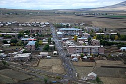
Tsaghkahovit (Armenian: Ծաղկահովիտ), known as Haji Khalil until 1946,[1] is a village in the Aragatsotn Province of Armenia. There are many Late Bronze Age remains which are in the process of being excavated.
See also[]
References[]
- ^ John Brady Kiesling, Raffi Kojian (2001). Rediscovering Armenia: An Archaeological/touristic Gazetteer and Map Set for the Historical Monuments of Armenia. Yerevan: Tigran Mets; p. 23
- Tsaghkahovit at GEOnet Names Server
- World Gazetteer: Armenia[dead link] – World-Gazetteer.com
- Report of the results of the 2001 Armenian Census, Statistical Committee of Armenia
- Kiesling, Rediscovering Armenia, p. 23, available online at the US embassy to Armenia's website

This article about a location in Aragatsotn Province, Armenia is a stub. You can help Wikipedia by . |
Categories:
- Populated places in Aragatsotn Province
- Aragatsotn geography stubs