Tsay Keh Airport
Tsay Keh Airport | |||||||||||
|---|---|---|---|---|---|---|---|---|---|---|---|
| Summary | |||||||||||
| Airport type | Public | ||||||||||
| Operator | Tsay Keh Dene Band | ||||||||||
| Location | Tsay Keh Dene First Nation | ||||||||||
| Time zone | PST (UTC−08:00) | ||||||||||
| • Summer (DST) | PDT (UTC−07:00) | ||||||||||
| Elevation AMSL | 2,285 ft / 696 m | ||||||||||
| Coordinates | 56°54′25″N 124°57′58″W / 56.90694°N 124.96611°WCoordinates: 56°54′25″N 124°57′58″W / 56.90694°N 124.96611°W | ||||||||||
| Map | |||||||||||
 CBN9 Location in British Columbia | |||||||||||
| Runways | |||||||||||
| |||||||||||
Source: Canada Flight Supplement[1] | |||||||||||


Tsay Keh Airport (TC LID: CBN9) is a registered aerodrome located on the banks of the Finlay River in British Columbia, Canada. The older Ingenika Airport nearby is no longer in regular use, but is maintained as an alternative, since visibility is sometimes acceptable there when it is not at Tsay Keh Airport.
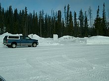
Tsay Keh Airport ground facilities in winter
References[]
| By name | |
|---|---|
| By location indicator | |
| By province/territory | |
| By area | |
| National Airports System | |
| Related | |
| |
This article about an airport in British Columbia is a stub. You can help Wikipedia by . |
Categories:
- Registered aerodromes in British Columbia
- Peace River Regional District
- British Columbia airport stubs