Tsugaru Strait
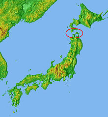


The Tsugaru Strait (津軽海峡, Tsugaru Kaikyō) is a strait between Honshu and Hokkaido in northern Japan connecting the Sea of Japan with the Pacific Ocean. It was named after the western part of Aomori Prefecture. The Seikan Tunnel passes under it at its narrowest point 12.1 miles (19.5 km) between Tappi Misaki on the Tsugaru Peninsula in Aomori Prefecture, Honshu, and Shirakami Misaki on the Matsumae Peninsula in Hokkaido.
Western maps in prior to the 20th century also referred to this waterway as the Strait of Sangar.[1]
Japan's territorial waters extend to three nautical miles (5.6 km) into the strait instead of the usual twelve, reportedly to allow nuclear-armed United States Navy warships and submarines to transit the strait without violating Japan's prohibition against nuclear weapons in its territory.[2] The part of the Seikan Tunnel that passes under the strait is considered to be under Japanese jurisdiction. The part of the Tsugaru Strait considered to be in international waters is still within Japan's exclusive economic zone.[3]
The Tsugaru Strait has eastern and western necks, both approximately 20 km across with maximum depths of 200 m and 140 m respectively.[4]
There are also ferry services that operate across the strait, including the Tsugaru Kaikyō Ferry and the Seikan ferry.
On September 26, 1954, 1,172 lives were lost when the ferry Tōya Maru sank in the strait.[5]
Thomas Blakiston, an English explorer and naturalist, noticed that animals in Hokkaido were related to northern Asian species, whereas those on Honshu to the south were related to those from southern Asia. The Tsugaru Strait was therefore established as a major zoogeographical boundary, and became known as Blakiston's Line or the "Blakiston Line".[6]
References[]
- ^ "Tsugaru Strait"
- ^ Kyodo News, "Japan left key straits open for U.S. nukes", The Japan Times, June 22, 2009.
- ^ http://www1.kaiho.mlit.go.jp/JODC/ryokai/ryokai_setsuzoku.html
- ^ Tsuji, H., Sawada, T. and Takizawa, M. (1996). "Extraordinary inundation accidents in the Seikan undersea tunnel". Proceedings of the Institution of Civil Engineers, Geotechnical Engineering. 119 (1): 1–14. doi:10.1680/igeng.1996.28131.CS1 maint: multiple names: authors list (link)
- ^ "Seikan Railroad Ferryboat Accident, Failure Knowledge Database". Japan Science and Technology Agency. Archived from the original on 2010-07-22.
- ^ "Nature in Japan" (PDF). Ministry of the Environment Government of Japan.
External links[]
 Media related to Tsugaru Strait at Wikimedia Commons
Coordinates: 41°29′57″N 140°36′57″E / 41.49917°N 140.61583°E

| hide Authority control | |
|---|---|
| General | |
| National libraries | |
- Straits of Japan
- Landforms of Aomori Prefecture
- Landforms of Hokkaido