Tupã, São Paulo
Tupã | |
|---|---|
 City Hall at night | |
 Flag  Coat of arms | |
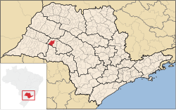 Location in São Paulo state | |
 Tupã Location in Brazil | |
| Coordinates: 21°56′5″S 50°30′49″W / 21.93472°S 50.51361°WCoordinates: 21°56′5″S 50°30′49″W / 21.93472°S 50.51361°W | |
| Country | Brazil |
| Region | Southeast |
| State | São Paulo |
| Area | |
| • Total | 628 km2 (242 sq mi) |
| Population (2020 [1]) | |
| • Total | 65,570 |
| • Density | 100/km2 (270/sq mi) |
| Time zone | UTC-03:00 (BRT) |
| • Summer (DST) | UTC-02:00 (BRST) |

Tupã is a municipality in the state of São Paulo in Brazil. The population is 65,570 (2020 est.) in an area of 628 km².[2] The city is located in the Region and it is located 530 km (329.32 sq mi) from capital São Paulo. It was founded on October 12, 1929 by Luiz de Souza Leão a business man that chose the region that were tropical forest. The city is located between 2 rivers: Aguapeí River and Rio do Peixe.
The name of the city is a Guaraní word meaning "God".[citation needed]

Tupã Downtown
References[]
- ^ IBGE 2020
- ^ "IBGE - Instituto Brasileiro de Geografia e Estatística". Retrieved 9 August 2016.
External links[]
- (in Portuguese) Tupã City Hall Website
- (in Portuguese) Tourism Information (provided by the City Hall)
- (in Portuguese) Satellite image of Tupã on Google Maps
| hide Authority control | |
|---|---|
| General |
|
| National libraries | |
This geographical article relating to the state of São Paulo is a stub. You can help Wikipedia by . |
Categories:
- Tupã, São Paulo
- São Paulo (state) geography stubs