Turkistan Region
Turkistan Region | |
|---|---|
 | |
 Coat of arms | |
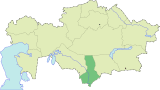
 Map of Kazakhstan, location of Turkistan Region highlighted | |
| Coordinates: 43°00′N 068°30′E / 43.000°N 68.500°ECoordinates: 43°00′N 068°30′E / 43.000°N 68.500°E | |
| Country | |
| Capital | Turkistan |
| Government | |
| • Akim | Janseyit Tuimebayev |
| Area | |
| • Total | 117,249 km2 (45,270 sq mi) |
| Population (2013-02-01)[2] | |
| • Total | 2,685,009 |
| • Density | 23/km2 (59/sq mi) |
| Time zone | UTC+6 (East) |
| • Summer (DST) | UTC+6 (not observed) |
| Postal codes | 160000 |
| Area codes | +7 (725) |
| ISO 3166 code | KZ-YUZ |
| Vehicle registration | 13, X |
| Districts | 11 |
| Cities | 8 |
| Townships | 13 |
| Villages | 932 |
| Website | www |

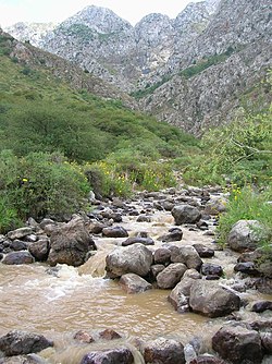
Turkistan Region, previously South Kazakhstan Region (Kazakh: Ońtústik Qazaqstan oblysy, Оңтүстік Қазақстан облысы; Russian: Южно-Казахстанская область, Yuzhno-Kazakhstanskaya oblast) is the southernmost region of Kazakhstan. Population: 2,469,367 (2009 Census results);[3] 1,978,339 (1999 Census results).[3] Its capital is Turkestan, formerly Shymkent in 2018. Other cities in South Kazakhstan include Sayram, Kentau, Arys, Shardara, Zhetisai, Saryagash, and Lenger. This region and Atyrau Region are Kazakhstan's two smallest regions; both are about 117,300 square kilometers in area. Turkistan Region borders the neighboring country of Uzbekistan (and is very near the Uzbekistan capital Tashkent), as well as three other Kazakhstan regions: Karaganda Region (to the north), Kyzylorda Region (to the west), and Jambyl Region (to the east). The Syr Darya passes through the region, on its way to the Aral Sea. Also, an oil pipeline runs from Turkmenabat, Turkmenistan to Omsk, Russia (where it connects with a larger, Siberian pipeline) through South Kazakhstan. Oil, lead and zinc are refined in Shymkent.
The Region was created as South Kazakhstan Oblast in Kazakh SSR of Soviet Union. Between 1962 and 1992 it was named Chimkent Oblast. The administrative center of the Region was Shymkent. On 19 June 2018 Shymkent was taken out of the Region and subordinated directly to the government of Kazakhstan, the administrative center moved to Turkistan, and the Region renamed Turkistan Region.[4]
Administrative divisions[]
As of 2013, the region was administratively divided into eleven districts and the cities of Shymkent, Arys, Kentau, and Turkestan.[5]
- Baydibek District, with the administrative center in the selo of Shayan;
- Kazygurt District, the selo of ;
- Maktaaral District, the town of Zhetisay;
- Ordabasy District, the selo of ;
- Otyrar District, the selo of ;
- Saryagash District, the town of Saryagash;
- Sayram District, the selo of ;
- Shardara District, the town of Shardara;
- Sozak District, the selo of ;
- Tole Bi District, the town of Lenger;
- Tulkibas District, the selo of .
References[]
- ^ Official site - General Information Archived 2011-07-22 at the Wayback Machine
- ^ Agency of statistics of the Republic of Kazakhstan: Численность населения Республики Казахстан по областям с началa 2013 года до 1 февраля 2013 года[permanent dead link] (russisch; Excel-Datei; 55 kB).
- ^ Jump up to: a b "Население Республики Казахстан" (in Russian). Департамент социальной и демографической статистики. Retrieved 8 December 2013.
- ^ "Публичное подписание Указа "О некоторых вопросах административно-территориального устройства Республики Казахстан"" (in Russian). President of Kazakhstan. 19 June 2018. Retrieved 21 June 2018.
- ^ "Akimats of the region's cities and districts". The official portal of akimat of South Kazakhstan Region. Archived from the original on 19 December 2012. Retrieved 20 March 2013.
- National Geographic Atlas of the World, Eighth Edition.
External links[]
![]() Media related to Turkistan Province at Wikimedia Commons
Media related to Turkistan Province at Wikimedia Commons
| show Places adjacent to Turkistan Region |
|---|
| show Authority control |
|---|
- Turkistan Region
- Regions of Kazakhstan