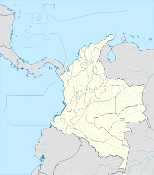
Tutunendo
Tutunendó | |
|---|---|
| Coordinates: 5°44′37.0″N 76°32′16.1″W / 5.743611°N 76.537806°WCoordinates: 5°44′37.0″N 76°32′16.1″W / 5.743611°N 76.537806°W | |
| Country | |
| Department | Chocó |
| Municipality | |
| Elevation | 177 ft (54 m) |
| Population (2005) | |
| • Total | 1,764[1] |
| Time zone | UTC-5 (Colombia Standard Time) |
Tutunendo is a Colombian district of the municipality of Quibdó , located in the department of Chocó . It is located 14 km from Quibdó , on the Quibdó - Medellín road. Declared a site of greater rainfall and Biodiversity. Its economic activities are: Agriculture, fishing, exploitation and extraction of minerals and wood resources and tourism in the weekend season by tourists, mostly from the city of Quibdó.
The township of Tutunendo ( Quibdó municipality ) is part of the Chocó Biogeographic and has an area of 43 square kilometers where much of the biodiversity is housed as it is a humid rain forest, which has made the area considered the main tourist center of the municipality of Quibdó, as an appropriate place for recreation and research for environmental entities.
Climate[]
Tutunendo has an extremely wet tropical rainforest climate (Af). It is one of the wettest places on earth.
| Climate data for Tutunendo | |||||||||||||
|---|---|---|---|---|---|---|---|---|---|---|---|---|---|
| Month | Jan | Feb | Mar | Apr | May | Jun | Jul | Aug | Sep | Oct | Nov | Dec | Year |
| Average high °C (°F) | 30.0 (86.0) |
30.3 (86.5) |
30.6 (87.1) |
30.8 (87.4) |
31.1 (88.0) |
30.9 (87.6) |
31.1 (88.0) |
31.2 (88.2) |
30.9 (87.6) |
30.5 (86.9) |
30.3 (86.5) |
29.8 (85.6) |
30.6 (87.1) |
| Daily mean °C (°F) | 26.4 (79.5) |
26.7 (80.1) |
26.9 (80.4) |
26.9 (80.4) |
27.0 (80.6) |
26.8 (80.2) |
26.8 (80.2) |
26.8 (80.2) |
26.5 (79.7) |
26.3 (79.3) |
26.2 (79.2) |
26.2 (79.2) |
26.6 (79.9) |
| Average low °C (°F) | 23.4 (74.1) |
23.4 (74.1) |
23.5 (74.3) |
23.6 (74.5) |
23.5 (74.3) |
23.3 (73.9) |
23.1 (73.6) |
23.1 (73.6) |
23.1 (73.6) |
23.0 (73.4) |
23.1 (73.6) |
23.3 (73.9) |
23.3 (73.9) |
| Average rainfall mm (inches) | 874.2 (34.42) |
743.8 (29.28) |
764.8 (30.11) |
962.8 (37.91) |
1,062.9 (41.85) |
1,003.3 (39.50) |
1,070.9 (42.16) |
1,092.5 (43.01) |
1,073.7 (42.27) |
1,019.4 (40.13) |
1,020.6 (40.18) |
907.2 (35.72) |
11,596.1 (456.54) |
| Average rainy days | 20 | 17 | 18 | 21 | 22 | 21 | 23 | 24 | 23 | 22 | 24 | 22 | 257 |
| Source: [2] | |||||||||||||
References[]
- ^ "Tutunendó (Quibdó, Chocó, Colombia) - Population Statistics, Charts, Map, Location, Weather and Web Information". www.citypopulation.de.
- ^ "Data". www.ideam.gov.co. Retrieved 2020-06-26.
- Townships


