Užava lowland
| Užava lowland | |
|---|---|
| Latvian: Užavas lejtece | |
 Foggy day in Užavas polder. | |
 | |
| Location | Latvia, Courland |
| Nearest city | Ventspils |
| Coordinates | 57°09′22″N 21°29′59″E / 57.15611°N 21.49972°ECoordinates: 57°09′22″N 21°29′59″E / 57.15611°N 21.49972°E |
| Area | 14.34 km2 (5.54 sq mi)[1] |
| Established | 2004 |
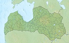
Užava lowland is nature park[2] Ventspils Municipality. It is located in the Užava river floodplain Užavas and Ziru parishes, occupies a large part of the currently dysfunctional Užava polder. Natura 2000 site.
Important bird habitat[]
The nature park was established in 2004 and has been recognised as an Important Bird Area (IBA) by BirdLife International because it supports populations of whooper swan (Cygnus cygnus), taiga bean goose (Anser fabalis), corncrake (Crex crex) during their migration and nesting.[3] Birds, mainly waterfowl (geese, swans, ducks, gulls), congregate here during spring migration to rest in flooded fields and meadows. During the autumn migration, the concentration of birds in the territory of the nature park was not observed. The most important nesting bird species in the park are northern lapwing, corn crake, common quail, lesser spotted eagle, Montagu's harrier, etc.[4]
See also[]
References[]
- ^ Užavas Lejtece Protected Planet
- ^ Nature Protection Board. Downstream of Užava
- ^ "Uzava lowland". BirdLife Data Zone. BirdLife International. 2021. Retrieved 20 September 2021.
- ^ SPECIALLY PROTECTED NATURE AREA NATURE PARK “UŽAVAS LEJTECE” NATURE PROTECTION PLAN
- IUCN Category II
- Natura 2000 in Latvia
- Nature parks in Latvia
- Ventspils Municipality
- Important Bird Areas of Latvia
- Courland geography stubs
