U.S. Route 10 in North Dakota
 | ||||
|---|---|---|---|---|
 US 10 highlighted in red | ||||
| Route information | ||||
| Maintained by NDDOT | ||||
| Length | 8.043 mi[2] (12.944 km) | |||
| Existed | 1926[1]–present | |||
| Major junctions | ||||
| West end | ||||
| East end | ||||
| Location | ||||
| Counties | Cass | |||
| Highway system | ||||
| ||||
| ||||
In North Dakota, U.S. Route 10 (US 10) runs 8.042 miles (12.942 km) from I-94/US 52 near West Fargo east through Fargo, North Dakota before crossing the Red River of the North and entering Moorhead, Minnesota. US 10 serves as a primary east-west corridor through the Fargo metropolitan area (Main Avenue) and is concurrent with I-94 Business Loop for its entire length in North Dakota.
Route description[]
This section needs expansion. You can help by . (July 2021) |
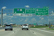
US 10 begins as a four-lane highway with a median at a trumpet interchange with I-94/US 52 (exit 343) just west of West Fargo. Once entering West Fargo, US 10 passes to the north of Bonanzaville, USA, a history museum complex before entering the downtown area of West Fargo. Continuing east, US 10 enters Fargo at its intersection with 45th St. and then intersects I-29/US 81 (exit 65) at a parclo interchange a mile later. East of this interchange, US 10 loses its median but remains two lanes each direction after intersecting 25th St. After this intersection, US 10 curves slightly southeast and runs along the Northern Transcon railroad tracks, heading into downtown. In downtown Fargo, US 10 passes to the south of the former Fargo railway station, which is listed on the National Register of Historic Places. At the east end of downtown Fargo, US 10 intersects 2nd St. at a roundabout before crossing over the Red River of the North and into Moorhead, Minnesota on the Veterans Memorial Bridge.
All of US 10 in North Dakota is part of the National Highway System,[3] a network of highways that are considered essential to the country's economy, defense, and mobility by the Federal Highway Administration.[3]
History[]
This section needs expansion. You can help by . (July 2021) |
Major intersections[]
The entire route is in Cass County.
| Location | mi[2] | km | Destinations | Notes | |
|---|---|---|---|---|---|
| | 0.000 | 0.000 | Western terminus of US 10; western end of I-94 Bus. concurrency; I-94 exit 343 | ||
| Fargo | 5.009 | 8.061 | I-29 exit 65 | ||
| Red River of the North | 8.043 | 12.944 | Veterans Memorial Bridge; North Dakota–Minnesota line | ||
| Continuation into Minnesota | |||||
1.000 mi = 1.609 km; 1.000 km = 0.621 mi
| |||||
References[]
- ^ Bureau of Public Roads & American Association of State Highway Officials (November 11, 1926). United States System of Highways Adopted for Uniform Marking by the American Association of State Highway Officials (Map). 1:7,000,000. Washington, DC: United States Geological Survey. OCLC 32889555. Retrieved July 8, 2021 – via Wikimedia Commons.
- ^ a b "Route and Mileage Map Insets" (PDF). North Dakota Department of Transportation. 2016. Retrieved July 8, 2021.
- ^ a b Natzke, Stefan; Neathery, Mike & Adderly, Kevin (June 20, 2012). "What is the National Highway System?". National Highway System. Washington, DC: Federal Highway Administration. Retrieved July 1, 2012.
External links[]
Route map:

| ( • help)
|
- U.S. Highways in North Dakota
- U.S. Route 10
- Transportation in Cass County, North Dakota