Cass County, North Dakota
Cass County | |
|---|---|
U.S. county | |
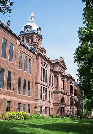 Cass County Courthouse in Fargo | |
 Location within the U.S. state of North Dakota | |
 North Dakota's location within the U.S. | |
| Coordinates: 46°56′N 97°15′W / 46.93°N 97.25°W | |
| Country | |
| State | |
| Founded | 1873 |
| Named for | George Washington Cass |
| Seat | Fargo |
| Largest city | Fargo |
| Area | |
| • Total | 1,768 sq mi (4,580 km2) |
| • Land | 1,765 sq mi (4,570 km2) |
| • Water | 3.0 sq mi (8 km2) 0.2% |
| Population (2020) | |
| • Total | 184,525 |
| • Density | 100/sq mi (40/km2) |
| Time zone | UTC−6 (Central) |
| • Summer (DST) | UTC−5 (CDT) |
| Congressional district | At-large |
| Website | www |

Cass County is a county in the U.S. state of North Dakota. As of the 2020 United States Census, the population was 184,525.[1] Cass County is the most populous county in North Dakota, accounting for nearly 24% of the state's population.[2][3] The county seat is Fargo,[4] the state's most populous city.
Cass County is part of the Fargo, ND-MN Metropolitan Statistical Area.
History[]
Cass County was defined by action of the Dakota Territory legislature on January 4, 1873, and its organization was effected on October 27 of that year. It was named for railroad executive George Washington Cass (1810 - 1888).[5] Its boundaries were altered in 1875, and in 1961.[6][7]
Geography[]
Cass County lies on the east side of North Dakota. Its east boundary line abuts the west boundary line of the state of Minnesota across the river. The Red River flows northward along the county's east boundary, on its way to Lake Winnipeg and Hudson Bay. The county's terrain consists of low rolling hills, devoted to agriculture except around developed areas.[8] Its terrain slopes to the north and east, with its highest point on the southwestern corner at 1,194' (364m) ASL.[9] The county has a total area of 1,768 square miles (4,580 km2), of which 1,765 square miles (4,570 km2) is land and 3.0 square miles (7.8 km2) (0.2%) is water.[10]
Major highways[]
Adjacent counties[]
- Traill County - north
- Norman County, Minnesota - northeast
- Clay County, Minnesota - east
- Richland County - southeast
- Ransom County - southwest
- Barnes County - west
- Steele County - northwest
Lakes[]
Cass County has the following lakes:[8]
- Brewer Lake
- Lake Bertha
Demographics[]
| Historical population | |||
|---|---|---|---|
| Census | Pop. | %± | |
| 1880 | 8,998 | — | |
| 1890 | 19,613 | 118.0% | |
| 1900 | 28,625 | 45.9% | |
| 1910 | 33,935 | 18.6% | |
| 1920 | 41,477 | 22.2% | |
| 1930 | 48,735 | 17.5% | |
| 1940 | 52,849 | 8.4% | |
| 1950 | 58,877 | 11.4% | |
| 1960 | 66,947 | 13.7% | |
| 1970 | 73,653 | 10.0% | |
| 1980 | 88,247 | 19.8% | |
| 1990 | 102,874 | 16.6% | |
| 2000 | 123,138 | 19.7% | |
| 2010 | 149,778 | 21.6% | |
| 2020 | 184,525 | 23.2% | |
| US Decennial Census[11] 1790-1960[12] 1900-1990[13] 1990-2000[14] 2010-2020[1] | |||
2000 census[]
As of the 2000 United States Census, there were 123,138 people, 51,315 households, and 29,814 families in the county. The population density was 70 people per square mile (27/km2). There were 53,790 housing units at an average density of 30 per square mile (12/km2). The racial makeup of the county was 95.10% White, 0.81% Black or African American, 1.08% Native American, 1.26% Asian, 0.03% Pacific Islander, 0.43% from other races, and 1.29% from two or more races. 1.23% of the population were Hispanic or Latino of any race. 34.1% were of German and 32.4% Norwegian ancestry.
There were 51,315 households, out of which 29.9% had children under the age of 18 living with them, 47.3% were married couples living together, 7.6% had a female householder with no husband present, and 41.9% were non-families. 31.2% of all households were made up of individuals, and 7.6% had someone living alone who was 65 years of age or older. The average household size was 2.32 and the average family size was 2.98.
The county population contained 23.4% under the age of 18, 16.0% from 18 to 24, 31.3% from 25 to 44, 19.6% from 45 to 64, and 9.7% who were 65 years of age or older. The median age was 31 years. For every 100 females, there were 100.3 males. For every 100 females age 18 and over, there were 99.5 males.
The median income for a household in the county was $38,147, and the median income for a family was $51,469. Males had a median income of $32,216 versus $22,300 for females. The per capita income for the county was $20,889. About 5.7% of families and 10.1% of the population were below the poverty line, including 9.1% of those under age 18 and 8.1% of those age 65 or over.
2010 census[]
As of the 2010 census, there were 149,778 people, 63,899 households, and 35,215 families in the county.[15] The population density was 84.9 inhabitants per square mile (32.8/km2). There were 67,938 housing units at an average density of 38.5 per square mile (14.9/km2).[16] The racial makeup of the county was 91.7% white, 2.4% Asian, 2.3% black or African American, 1.2% American Indian, 0.5% from other races, and 1.9% from two or more races. Those of Hispanic or Latino origin made up 2.0% of the population.[15] In terms of ancestry, 45.4% were German, 35.8% were Norwegian, 9.2% were Irish, 6.3% were Swedish, and 1.7% were American.[17]
Of the 63,899 households, 27.8% had children under the age of 18 living with them, 42.9% were married couples living together, 8.3% had a female householder with no husband present, 44.9% were non-families, and 33.0% of all households were made up of individuals. The average household size was 2.27 and the average family size was 2.94. The median age was 31.5 years.[15]
The median income for a household in the county was $47,600 and the median income for a family was $68,858. Males had a median income of $42,557 versus $31,916 for females. The per capita income for the county was $28,184. About 5.8% of families and 12.8% of the population were below the poverty line, including 11.0% of those under age 18 and 10.1% of those age 65 or over.[18]
Population by decade[]

Government[]
Cass County is governed by a board of commissioners elected to four-year terms. Other elected officials include the sheriff and state's attorney. Appointed officials include administrator, extension agent, director of tax equalization, finance auditor, highway engineer, human services officer, information technology coordinator, recorder, veterans service officer, and weed control officer.
| District | Commissioner | In office since | Current term expires in |
|---|---|---|---|
| 1st | Chad Peterson (Chair) | 2012 | 2020 |
| 2nd | Rick Steen (vice chair) | 2014 | 2022 |
| 3rd | Ken Pawluk | 2019 | 2020 |
| 4th | Duane Breitling | 2018 | 2022 |
| 5th | Mary Scherling | 2012 | 2020 |
The current Sheriff is Jesse F. Jahner. Jahner has served as Sheriff of Cass County since January 2, 2019.
The voters of Cass County have historically tended to vote Republican. As recently as the 2004 presidential election, George W. Bush carried Cass County with nearly 60 percent of the vote. However, in recent elections, the county has become more politically diverse and competitive, particularly in Fargo. Since 2008, no Republican presidential candidate has received over 50% of the vote in Cass County. In 2008, Democratic candidate Barack Obama won the majority of votes in Cass County, with a voting percentage very close to the percentage Obama received in the entire nation, while John McCain won the majority of votes in North Dakota. Mitt Romney's winning margin in 2012 over Obama in Cass County was 49.9% to 47%, while Donald Trump received 49.3% of votes in 2016, compared to 38.8% for Hillary Clinton and 11.9% for third party candidates. In 2018, Democratic Senator Heidi Heitkamp achieved a 14-point lead in Eastern North Dakota, although the state as a whole soundly elected Republican Kevin Cramer.
Communities[]

Cities[]
- Alice
- Amenia
- Argusville
- Arthur
- Ayr
- Briarwood
- Buffalo
- Casselton
- Davenport
- Enderlin
- Fargo (County seat)
- Frontier
- Gardner
- Grandin
- Harwood
- Horace
- Hunter
- Kindred
- Leonard
- Mapleton
- North River
- Oxbow
- Page
- Prairie Rose
- Reile's Acres
- Tower City
- West Fargo
Census-designated places[]
Unincorporated communities[]
Townships[]
See also[]
References[]
- ^ Jump up to: a b "U.S. Census Bureau QuickFacts: Cass County, North Dakota". www.census.gov. United States Census Bureau. Retrieved August 19, 2021.
- ^ Based on the 2020 Census: 184,525 / 779,094 (ND pop.) = 23.7%
- ^ "Top 100 Counties by Growth, 2017". US Census Bureau. Retrieved December 3, 2018.[dead link]
- ^ "Find a County". National Association of Counties. Archived from the original on May 31, 2011. Retrieved June 7, 2011.
- ^ Gannett, Henry (1905). The Origin of Certain Place Names in the US. Govt. Print. Off. p. 71.
- ^ "Dakota Territory, South Dakota, and North Dakota: Individual County Chronologies". Dakota Territory Atlas of Historical County Boundaries. The Newberry Library. 2006. Archived from the original on April 2, 2018. Retrieved February 2, 2015.
- ^ "County History". North Dakota.gov. The State of North Dakota. Archived from the original on February 2, 2015. Retrieved February 2, 2015.
- ^ Jump up to: a b Cass County ND Google Maps (accessed February 16, 2019)
- ^ ""Find an Altitude/Cass County ND" Google Maps (accessed February 16, 2019)". Archived from the original on May 21, 2019. Retrieved February 17, 2019.
- ^ "2010 Census Gazetteer Files". US Census Bureau. August 22, 2012. Archived from the original on January 29, 2015. Retrieved January 28, 2015.
- ^ "US Decennial Census". US Census Bureau. Retrieved January 28, 2015.
- ^ "Historical Census Browser". University of Virginia Library. Retrieved January 28, 2015.
- ^ Forstall, Richard L., ed. (March 27, 1995). "Population of Counties by Decennial Census: 1900 to 1990". US Census Bureau. Retrieved January 28, 2015.
- ^ "Census 2000 PHC-T-4. Ranking Tables for Counties: 1990 and 2000" (PDF). US Census Bureau. April 2, 2001. Retrieved January 28, 2015.
- ^ Jump up to: a b c "Profile of General Population and Housing Characteristics: 2010 Demographic Profile Data". US Census Bureau. Archived from the original on February 13, 2020. Retrieved March 14, 2016.
- ^ "Population, Housing Units, Area, and Density: 2010 - County". US Census Bureau. Archived from the original on February 13, 2020. Retrieved March 14, 2016.
- ^ "Selected Social Characteristics in the US – 2006-2010 American Community Survey 5-Year Estimates". US Census Bureau. Archived from the original on February 13, 2020. Retrieved March 14, 2016.
- ^ "Selected Economic Characteristics – 2006-2010 American Community Survey 5-Year Estimates". US Census Bureau. Archived from the original on February 13, 2020. Retrieved March 14, 2016.
- ^ Leip, David. "Atlas of US Presidential Elections". uselectionatlas.org. Retrieved April 12, 2018.
- ^ The leading "other" candidate, Progressive Theodore Roosevelt, received 1,316 votes, while Socialist candidate Eugene Debs received 164 votes, Prohibition candidate Eugene Chafin received 56 votes.
External links[]
- Cass County official website
- Cass County maps, Sheet 1 (northern) and Sheet 2 (southern), North Dakota DOT
| show Places adjacent to Cass County, North Dakota |
|---|
| show Municipalities and communities of Cass County, North Dakota, United States |
|---|


| show Authority control |
|---|
- North Dakota counties
- Cass County, North Dakota
- Fargo–Moorhead
- 1873 establishments in Dakota Territory
- Populated places established in 1873