Felton, Minnesota
Felton | |
|---|---|
 | |
 Location of Felton, Minnesota | |
| Coordinates: 47°4′38″N 96°30′16″W / 47.07722°N 96.50444°W | |
| Country | United States |
| State | Minnesota |
| County | Clay |
| Area | |
| • Total | 1.01 sq mi (2.63 km2) |
| • Land | 1.01 sq mi (2.63 km2) |
| • Water | 0.00 sq mi (0.00 km2) |
| Elevation | 912 ft (278 m) |
| Population | |
| • Total | 177 |
| • Estimate (2019)[3] | 172 |
| • Density | 169.46/sq mi (65.40/km2) |
| Time zone | UTC-6 (Central (CST)) |
| • Summer (DST) | UTC-5 (CDT) |
| ZIP code | 56536 |
| Area code(s) | 218 |
| FIPS code | 27-20834 |
| GNIS feature ID | 0643595[4] |

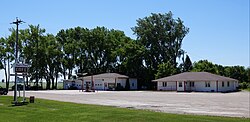
Felton is a city in Clay County, Minnesota, United States. The population was 177 at the 2010 census.[5]
Geography[]
According to the United States Census Bureau, the city has a total area of 1.03 square miles (2.67 km2), all land.[6]
Minnesota State Highway 9 serves as a main route in the community.

Demographics[]
| Historical population | |||
|---|---|---|---|
| Census | Pop. | %± | |
| 1910 | 149 | — | |
| 1920 | 184 | 23.5% | |
| 1930 | 137 | −25.5% | |
| 1940 | 200 | 46.0% | |
| 1950 | 258 | 29.0% | |
| 1960 | 201 | −22.1% | |
| 1970 | 232 | 15.4% | |
| 1980 | 264 | 13.8% | |
| 1990 | 211 | −20.1% | |
| 2000 | 216 | 2.4% | |
| 2010 | 177 | −18.1% | |
| 2019 (est.) | 172 | [3] | −2.8% |
| U.S. Decennial Census[7] 2013 Estimate[8] | |||
2010 census[]
As of the census[2] of 2010, there were 177 people, 78 households, and 44 families living in the city. The population density was 171.8 inhabitants per square mile (66.3/km2). There were 93 housing units at an average density of 90.3 per square mile (34.9/km2). The racial makeup of the city was 98.9% White and 1.1% Asian. Hispanic or Latino of any race were 2.8% of the population.
There were 78 households, of which 26.9% had children under the age of 18 living with them, 43.6% were married couples living together, 10.3% had a female householder with no husband present, 2.6% had a male householder with no wife present, and 43.6% were non-families. 37.2% of all households were made up of individuals, and 11.5% had someone living alone who was 65 years of age or older. The average household size was 2.27 and the average family size was 3.05.
The median age in the city was 40.8 years. 22% of residents were under the age of 18; 9.1% were between the ages of 18 and 24; 25.4% were from 25 to 44; 32.8% were from 45 to 64; and 10.7% were 65 years of age or older. The gender makeup of the city was 52.0% male and 48.0% female.
2000 census[]
As of the census of 2000, there were 216 people, 91 households, and 56 families living in the city. The population density was 211.0 people per square mile (81.8/km2). There were 97 housing units at an average density of 94.8 per square mile (36.7/km2). The racial makeup of the city was 97.22% White, 0% Asian, 1.85% from other races, and 0.46% from two or more races. Hispanic or Latino of any race were 5.09% of the population.
There were 91 households, out of which 31.9% had children under the age of 18 living with them, 49.5% were married couples living together, 9.9% had a female householder with no husband present, and 37.4% were non-families. 33.0% of all households were made up of individuals, and 13.2% had someone living alone who was 65 years of age or older. The average household size was 2.37 and the average family size was 3.12.
In the city, the population was spread out, with 31.5% under the age of 18, 4.2% from 18 to 24, 27.3% from 25 to 44, 24.1% from 45 to 64, and 13.0% who were 65 years of age or older. The median age was 35 years. For every 100 females, there were 92.9 males. For every 100 females age 18 and over, there were 102.7 males.
The median income for a household in the city was $26,477, and the median income for a family was $40,833. Males had a median income of $28,750 versus $18,750 for females. The per capita income for the city was $15,321. About 10.3% of families and 16.9% of the population were below the poverty line, including 26.3% of those under the age of eighteen and 12.8% of those 65 or over.
References[]
- ^ "2019 U.S. Gazetteer Files". United States Census Bureau. Retrieved July 26, 2020.
- ^ a b "U.S. Census website". United States Census Bureau. Retrieved 2012-11-13.
- ^ a b "Population and Housing Unit Estimates". United States Census Bureau. May 24, 2020. Retrieved May 27, 2020.
- ^ "US Board on Geographic Names". United States Geological Survey. 2007-10-25. Retrieved 2008-01-31.
- ^ "2010 Census Redistricting Data (Public Law 94-171) Summary File". American FactFinder. U.S. Census Bureau, 2010 Census. Retrieved 23 April 2011.[dead link]
- ^ "US Gazetteer files 2010". United States Census Bureau. Archived from the original on 2012-01-25. Retrieved 2012-11-13.
- ^ United States Census Bureau. "Census of Population and Housing". Retrieved September 11, 2013.
- ^ "Annual Estimates of the Resident Population: April 1, 2010 to July 1, 2013". Archived from the original on May 22, 2014. Retrieved June 9, 2014.
Municipalities and communities of Clay County, Minnesota, United States | ||
|---|---|---|
| Cities |  | |
| Townships | ||
| CDPs | ||
| Unincorporated communities | ||
| Ghost towns | ||
| ||
| Counties | ||
|---|---|---|
| Main cities | ||
| Surrounding areas |
| |
‡ - county seat | ||
Coordinates: 47°04′43″N 96°30′23″W / 47.07861°N 96.50639°W
- Cities in Minnesota
- Cities in Clay County, Minnesota