Grafton, North Dakota
Grafton, North Dakota | |
|---|---|
City | |
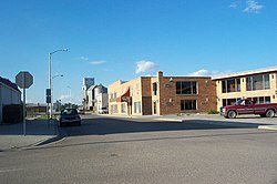 Downtown Grafton | |
 Location of Grafton, North Dakota | |
| Coordinates: 48°24′58″N 97°24′38″W / 48.41611°N 97.41056°WCoordinates: 48°24′58″N 97°24′38″W / 48.41611°N 97.41056°W | |
| Country | United States |
| State | North Dakota |
| County | Walsh |
| Founded | 1881 |
| Government | |
| • Mayor | |
| Area | |
| • Total | 3.57 sq mi (9.24 km2) |
| • Land | 3.30 sq mi (8.55 km2) |
| • Water | 0.26 sq mi (0.68 km2) |
| Elevation | 830 ft (253 m) |
| Population | |
| • Total | 4,284 |
| • Estimate (2020)[2] | 4,075 |
| • Density | 1,258.55/sq mi (485.96/km2) |
| Time zone | UTC−6 (Central (CST)) |
| • Summer (DST) | UTC−5 (CDT) |
| ZIP code | 58237 |
| Area code(s) | 701 |
| FIPS code | 38-31820 |
| GNIS feature ID | 1029194[4] |
| Highways | US 81, ND 17 |
| Website | Grafton.Gov |

Grafton is a city in the State of North Dakota and is the county seat of Walsh County.[5] As of the 2010 Census, the city of Grafton had a population of 4,284,[6] making it the fourteenth largest city in North Dakota. Grafton was founded in 1881.
History[]

The Grafton area was first settled by Thomas E Cooper in early 1879. He became postmaster later that year when a post office was constructed as part of expansions in service for the Northern Pacific Railway and the Great Northern Railway.[7] It was incorporated as a village in 1881 and then became a city in 1903.[8] In 1881, Walsh County was established and Grafton was subsequently designated the county seat.[9] The city was named for Grafton County, New Hampshire, the native home of a large share of its early settlers.[10]
The Grafton State School, a home for the developmentally disabled, is listed on the National Register of Historic Places.[11]
Government[]
The city employs a mayor-council government where the mayor is elected for a four-year term and eight city council members are elected to staggered four-year terms. There are four at-large members of the city council while the remaining four members are elected from the four wards of the city. Currently, Chris West is serving as mayor while the city council members are as follows: Shane Mohn (1st Ward), Greg Young (2nd Ward), Philip Ray (3rd Ward), Don Hutson (4th Ward), David Fellman (At-large), Chris Lipsh (At-large), Brian Sieben (At-large), and Mary Stark (At-large).
Geography[]
Grafton is located at 48°24′58″N 97°24′38″W / 48.416082°N 97.410633°W (48.416082, −97.410633).[12]
According to the U.S. Census Bureau, the city has a total area of 3.40 square miles (8.81 km2), all land.[13]
Demographics[]
| Historical population | |||
|---|---|---|---|
| Census | Pop. | %± | |
| 1890 | 1,594 | — | |
| 1900 | 2,378 | 49.2% | |
| 1910 | 2,229 | −6.3% | |
| 1920 | 2,512 | 12.7% | |
| 1930 | 3,136 | 24.8% | |
| 1940 | 4,070 | 29.8% | |
| 1950 | 4,901 | 20.4% | |
| 1960 | 5,885 | 20.1% | |
| 1970 | 5,946 | 1.0% | |
| 1980 | 5,293 | −11.0% | |
| 1990 | 4,840 | −8.6% | |
| 2000 | 4,516 | −6.7% | |
| 2010 | 4,284 | −5.1% | |
| 2020 (est.) | 4,075 | [2] | −4.9% |
| U.S. Decennial Census[14] 2020 Estimate[2] | |||
2010 census[]
As of the census[3] of 2010, there were 4,284 people, 1,776 households, and 1,073 families living in the city. The population density was 1,260.0 inhabitants per square mile (486.5/km2). There were 1,990 housing units at an average density of 585.3 per square mile (226.0/km2). The racial makeup of the city was 89.2% White, 0.4% African American, 2.8% Native American, 0.4% Asian, 0.1% Pacific Islander, 5.4% from other races, and 1.7% from two or more races. Hispanic or Latino of any race were 14.1% of the population.
There were 1,776 households, of which 27.6% had children under the age of 18 living with them, 45.4% were married couples living together, 10.2% had a female householder with no husband present, 4.8% had a male householder with no wife present, and 39.6% were non-families. 35.2% of all households were made up of individuals, and 15.4% had someone living alone who was 65 years of age or older. The average household size was 2.27 and the average family size was 2.92.
The median age in the city was 42.5 years. 23.5% of residents were under the age of 18; 8.1% were between the ages of 18 and 24; 21.5% were from 25 to 44; 27.7% were from 45 to 64; and 19.2% were 65 years of age or older. The gender makeup of the city was 48.4% male and 51.6% female.
2000 census[]
As of the census of 2000, there were 4,516 people, 1,804 households, and 1,143 families living in the city. The population density was 506.9/km2 (1,312.2/mi2). There were 2,005 housing units at an average density of 225.0/km2 (582.6/mi2). The racial makeup of the city was 91.67% White, 0.58% African American, 1.35% Native American, 0.38% Asian, 4.69% from other races, and 1.33% from two or more races. Hispanic or Latino of any race were 9.57% of the population, making Grafton the city with the highest percentage of Hispanics in North Dakota.[citation needed]
The top 6 ancestry groups in the city are Norwegian (39.4%), German (19.8%), French (8.9%), Polish (8.7%), Czech (8.3%), Irish (7.4%).
There were 1,804 households, out of which 31.2% had children under the age of 18 living with them, 49.6% were married couples living together, 10.4% had a female householder with no husband present, and 36.6% were non-families. 33.1% of all households were made up of individuals, and 16.6% had someone living alone who was 65 years of age or older. The average household size was 2.35 and the average family size was 2.98.
In the city, the population was spread out, with 24.2% under the age of 18, 7.4% from 18 to 24, 26.3% from 25 to 44, 23.1% from 45 to 64, and 19.0% who were 65 years of age or older. The median age was 40 years. For every 100 females, there were 92.3 males. For every 100 females age 18 and over, there were 89.1 males.
Education[]
The city of Grafton is served by the Grafton Public Schools system. The system includes Century Primary Elementary School (grades PK–2), Century Intermediate Elementary School grades (3–6) Grafton Junior High School (grades 7–8), and Grafton High School (grades 9–12).
North Valley Career and Technology Center is a multi-district regional technology education center, serving students grades 9-12 from across the region.
Library[]
Grafton's Carnegie Regional Library opened in 1897 and is North Dakota's first public library. Carnegie's collection contains 49,005 volumes and circulates 33,620 items per year. The library, including its 3 branches, serves a population of over 27,000 residents.[15]
Media[]
Local print and online news[]
- Walsh County Record
- Walsh County Daily News
Local radio[]
AM radio[]
| AM radio stations | |||||
|---|---|---|---|---|---|
| Frequency | Call sign | Name | Format | Owner | City |
| 1340 AM | KXPO | Expo Radio | Full service/Country | Simmons Broadcasting Inc. | Grafton |
FM radio[]
| FM radio stations | ||||||
|---|---|---|---|---|---|---|
| Frequency | Call sign | Name | Format | Owner | Target city/market | City of license |
| 100.9 FM | KAUJ | Oldies 101 | Oldies | Simmons Broadcasting Inc. | Grafton | Grafton |
Sites of interest[]
- Walsh County Courthouse – The Walsh County Courthouse has been listed on the National Register of Historic Places since 1985.
- Centennial Center
- Elmwood historic home[16]
- Fair Oaks Golf Club – a nine-hole golf course located in Grafton
- Grafton Winter Sports Arena – site of the former Winter Sports Arena, the first indoor hockey arena in North Dakota.
- Chandler Field - named after Albert "Happy" Chandler
Notable people[]
- Albert "Happy" Chandler, 44th and 49th governor of Kentucky; US senator; commissioner of Major League Baseball; Chandler Field is named after him[17][verification needed]
- Pablo Garza, mixed martial arts featherweight fighter with the Ultimate Fighting Championship
- William E. Gorder, teacher, farmer, and North Dakota state representative
- Les Lear, offensive tackle in the Canadian Football League and National Football League
- Raymond W. Lessard, bishop of Savannah (1973–1995)
- Clint Ritchie, actor (Clint Buchanan on One Life to Live)
- Barry Tallackson, forward for the St. Louis Blues
Notes[]
- ^ "2019 U.S. Gazetteer Files". United States Census Bureau. Retrieved July 27, 2020.
- ^ Jump up to: a b c "Population and Housing Unit Estimates". United States Census Bureau. June 14, 2021. Retrieved June 26, 2021.
- ^ Jump up to: a b "U.S. Census website". United States Census Bureau. Retrieved June 14, 2012.
- ^ "US Board on Geographic Names". United States Geological Survey. October 25, 2007. Retrieved January 31, 2008.
- ^ "Find a County". National Association of Counties. Archived from the original on May 31, 2011. Retrieved June 7, 2011.
- ^ "2010 Census Redistricting Data (Public Law 94-171) Summary File". American FactFinder. United States Census Bureau. Retrieved May 2, 2011.[dead link]
- ^ . Walsh County Historical Society http://www.walshhistory.org/walsh-county-cities-and-towns/grafton/. Missing or empty
|title=(help)|access-date=April 12, 2021}} - ^ Lounsberry, Clement Augustus (1919). Early History of North Dakota: Essential Outlines of American History. Liberty Press. p. 534.
- ^ Hellmann, Paul T. (May 13, 2013). Historical Gazetteer of the United States. Routledge. p. 836. ISBN 978-1135948597. Retrieved November 30, 2013.
- ^ Federal Writers' Project (1938). North Dakota, a Guide to the Northern Prairie State. WPA. p. 188. ISBN 978-1-62376-033-5.
- ^ "North Dakota – Walsh County". nationalregisterofhistoricplaces.com. Retrieved October 24, 2015.
- ^ "US Gazetteer files: 2010, 2000, and 1990". United States Census Bureau. February 12, 2011. Retrieved April 23, 2011.
- ^ "US Gazetteer files 2010". United States Census Bureau. Archived from the original on January 25, 2012. Retrieved June 14, 2012.
- ^ United States Census Bureau. "Census of Population and Housing". Retrieved August 6, 2013.
- ^ "Grafton ND Library".
- ^ [1] Archived January 22, 2008, at the Wayback Machine
- ^ Eriksmoen, Curt (2006). Did You Know That...?: 47 Fascinating Stories about People Who Have Lived in North Dakota. Vol.1. United States: McCleery & Sons Publishing. pp. 140–141. ISBN 1-931916-46-2.
|volume=has extra text (help)
External links[]
| show Municipalities and communities of Walsh County, North Dakota, United States |
|---|


| show Authority control |
|---|
- Cities in North Dakota
- Cities in Walsh County, North Dakota
- County seats in North Dakota
- Populated places established in 1881
- 1881 establishments in Dakota Territory