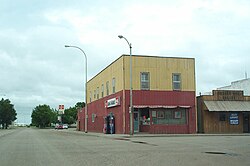
Minto, North Dakota
Minto, North Dakota | |
|---|---|
 Minto, North Dakota | |
 Location of Minto, North Dakota. (The upper map is the state of North Dakota with Walsh County in red; the lower map is Walsh County with Minto in red.) | |
| Coordinates: 48°17′32″N 97°22′21″W / 48.29222°N 97.37250°WCoordinates: 48°17′32″N 97°22′21″W / 48.29222°N 97.37250°W | |
| Country | United States |
| State | North Dakota |
| County | Walsh |
| Founded | 1881 |
| Area | |
| • Total | 1.44 sq mi (3.72 km2) |
| • Land | 1.44 sq mi (3.72 km2) |
| • Water | 0.00 sq mi (0.00 km2) |
| Elevation | 820 ft (250 m) |
| Population | |
| • Total | 604 |
| • Estimate (2019)[2] | 592 |
| • Density | 411.97/sq mi (159.02/km2) |
| Time zone | UTC-6 (Central (CST)) |
| • Summer (DST) | UTC-5 (CDT) |
| ZIP code | 58261 |
| Area code(s) | 701 |
| FIPS code | 38-53540 |
| GNIS feature ID | 1030252[4] |
| Website | cityofminto.com |

Minto is a city in Walsh County, North Dakota, United States. The population was 604 at the 2010 census.[5] Minto was founded in 1881.
History[]
A post office has been in operation at Minto since 1880.[6] Minto was incorporated in 1883.[7] The city was named after Minto, Ontario, the native home of a large share of the early settlers.[8]
Geography[]
Minto is located at 48°17′32″N 97°22′21″W / 48.29222°N 97.37250°W (48.292192, −97.372391).[9]
According to the United States Census Bureau, the city has a total area of 1.42 square miles (3.68 km2), all land.[10]
Demographics[]
| Historical population | |||
|---|---|---|---|
| Census | Pop. | %± | |
| 1890 | 467 | — | |
| 1900 | 860 | 84.2% | |
| 1910 | 701 | −18.5% | |
| 1920 | 602 | −14.1% | |
| 1930 | 565 | −6.1% | |
| 1940 | 630 | 11.5% | |
| 1950 | 592 | −6.0% | |
| 1960 | 642 | 8.4% | |
| 1970 | 636 | −0.9% | |
| 1980 | 592 | −6.9% | |
| 1990 | 560 | −5.4% | |
| 2000 | 657 | 17.3% | |
| 2010 | 604 | −8.1% | |
| 2019 (est.) | 592 | [2] | −2.0% |
| U.S. Decennial Census[11] 2018 Estimate[12] | |||
2010 census[]
As of the census[3] of 2010, there were 604 people, 255 households, and 173 families living in the city. The population density was 425.4 inhabitants per square mile (164.2/km2). There were 294 housing units at an average density of 207.0 per square mile (79.9/km2). The racial makeup of the city was 95.9% White, 0.3% African American, 0.2% Native American, 3.0% from other races, and 0.7% from two or more races. Hispanic or Latino of any race were 15.7% of the population.
There were 255 households, of which 31.0% had children under the age of 18 living with them, 54.1% were married couples living together, 7.1% had a female householder with no husband present, 6.7% had a male householder with no wife present, and 32.2% were non-families. 29.4% of all households were made up of individuals, and 9.8% had someone living alone who was 65 years of age or older. The average household size was 2.37 and the average family size was 2.92.
The median age in the city was 42.9 years. 24.5% of residents were under the age of 18; 7.1% were between the ages of 18 and 24; 20.6% were from 25 to 44; 32.2% were from 45 to 64; and 15.6% were 65 years of age or older. The gender makeup of the city was 52.6% male and 47.4% female.
2000 census[]
As of the census of 2000, there were 657 people, 269 households, and 185 families living in the city. The population density was 458.9 people per square mile (177.4/km2). There were 298 housing units at an average density of 208.2 per square mile (80.5/km2). The racial makeup of the city was 96.35% White, 0.76% Native American (i.e. five persons), 0.15% Asian (one person), 1.37% from other races (i.e. nine persons), and 1.37% from two or more races (nine persons). 4.87% of the population (32 persons) were Hispanic or Latino of any race.
There were 269 households, out of which 33.5% had children under the age of 18 living with them, 55.0% were married couples living together, 10.0% had a female householder with no husband present, and 31.2% were non-families. 26.8% of all households were made up of individuals, and 12.6% had someone living alone who was 65 years of age or older. The average household size was 2.44 and the average family size was 2.98.
In the city, the population was spread out, with 27.5% under the age of 18, 5.2% from 18 to 24, 26.9% from 25 to 44, 25.4% from 45 to 64, and 14.9% who were 65 years of age or older. The median age was 39 years. For every 100 females, there were 106.6 males. For every 100 females age 18 and over, there were 97.5 males.
The median income for a household in the city was $34,643, and the median income for a family was $43,167. Males had a median income of $28,611 versus $19,083 for females. The per capita income for the city was $18,011. About 5.4% of families and 7.8% of the population were below the poverty line, including 11.1% of those under age 18 and 9.2% of those age 65 or over.
Ancestries: Polish (34.6%), German (26.6%), Norwegian (21.3%), Czech (8.7%), Irish (8.2%), French (5.3%).
Education[]
K–12[]
serves Minto and the surrounding rural areas of southeastern Walsh County. The school was named one of the best 100 schools in The United States by the now defunct .[13]
References[]
- ^ "2019 U.S. Gazetteer Files". United States Census Bureau. Retrieved July 27, 2020.
- ^ Jump up to: a b "Population and Housing Unit Estimates". United States Census Bureau. May 24, 2020. Retrieved May 27, 2020.
- ^ Jump up to: a b "U.S. Census website". United States Census Bureau. Retrieved June 14, 2012.
- ^ "US Board on Geographic Names". United States Geological Survey. October 25, 2007. Retrieved January 31, 2008.
- ^ "2010 Census Redistricting Data (Public Law 94-171) Summary File". American FactFinder. United States Census Bureau. Retrieved May 2, 2011.[dead link]
- ^ "Walsh County". Jim Forte Postal History. Retrieved October 23, 2015.
- ^ United States of America Congressional Record Proceedings and Debates of the 110th Congress Second Session Volume 154-Part 10. Government Printing Office. p. 138. GGKEY:GXD1UU6ULDQ.
- ^ Federal Writers' Project (1938). North Dakota, a Guide to the Northern Prairie State,. WPA. p. 189. ISBN 978-1-62376-033-5.
- ^ "US Gazetteer files: 2010, 2000, and 1990". United States Census Bureau. 2011-02-12. Retrieved 2011-04-23.
- ^ "US Gazetteer files 2010". United States Census Bureau. Archived from the original on 2011-02-20. Retrieved 2012-06-14.
- ^ United States Census Bureau. "Census of Population and Housing". Retrieved August 7, 2013.
- ^ "Population Estimates". United States Census Bureau. Retrieved June 11, 2019.
- ^ "The 100 Best School Districts." Offspring Magazine Sep./Oct. 2000
| show Municipalities and communities of Walsh County, North Dakota, United States |
|---|

| show Authority control |
|---|
- Cities in North Dakota
- Cities in Walsh County, North Dakota
- Populated places established in 1881
- 1881 establishments in Dakota Territory