Ungersheim
Ungersheim
Ungersche | |
|---|---|
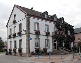 The town hall in Ungersheim | |
 Coat of arms | |
show Location of Ungersheim | |
 Ungersheim | |
| Coordinates: 47°52′46″N 7°18′19″E / 47.8794°N 7.3053°ECoordinates: 47°52′46″N 7°18′19″E / 47.8794°N 7.3053°E | |
| Country | France |
| Region | Grand Est |
| Department | Haut-Rhin |
| Arrondissement | Mulhouse |
| Canton | Wittenheim |
| Intercommunality | Mulhouse Alsace Agglomération |
| Government | |
| • Mayor (2020–2026) | Jean-Claude Mensch[1] |
| Area 1 | 13.51 km2 (5.22 sq mi) |
| Population (Jan. 2018)[2] | 2,379 |
| • Density | 180/km2 (460/sq mi) |
| Time zone | UTC+01:00 (CET) |
| • Summer (DST) | UTC+02:00 (CEST) |
| INSEE/Postal code | 68343 /68190 |
| Elevation | 212–241 m (696–791 ft) (avg. 220 m or 720 ft) |
| 1 French Land Register data, which excludes lakes, ponds, glaciers > 1 km2 (0.386 sq mi or 247 acres) and river estuaries. | |


Ungersheim (Alemannic German: Ungersche) is a commune in the Haut-Rhin department of Grand Est in eastern France. It forms part of the Mulhouse Alsace Agglomération, the inter-communal local government body for the Mulhouse conurbation.[3]
It is known for:
- the , an open-air museum showing:
- 70 old, rebuilt Alsatian-style houses;
- many workshops of local traditional crafts with working craftspeople;
- the "Eden Palladium", a unique museum of old-timer carrousels and attractions still working;
- "Le Bioscope", a leisure park dedicated to environmental questions, proposing amusing and educating activities.

Saint Michael Church

Silo of EAGGF


See also[]
References[]
- ^ "Répertoire national des élus: les maires". data.gouv.fr, Plateforme ouverte des données publiques françaises (in French). 2 December 2020. Retrieved 7 December 2020.
- ^ "Populations légales 2018". INSEE. 28 December 2020.
- ^ "Mulhouse Alsace Agglomération". Mulhouse Alsace Agglomération. Retrieved 2011-04-07.
External links[]
| Wikimedia Commons has media related to Ungersheim. |
- Official site of the Écomusée d'Alsace (in French) and German
- Official site of the Bioscope (in French) and German
| show Authority control |
|---|
This Haut-Rhin geographical article is a stub. You can help Wikipedia by . |
Categories:
- Communes of Haut-Rhin
- Haut-Rhin geography stubs