Union Township, Calhoun County, Iowa
Union Township, Calhoun County | |
|---|---|
 | |
| Coordinates: 42°15′04″N 094°34′56″W / 42.25111°N 94.58222°WCoordinates: 42°15′04″N 094°34′56″W / 42.25111°N 94.58222°W | |
| Country | |
| State | |
| County | Calhoun |
| Area | |
| • Total | 35.47 sq mi (91.86 km2) |
| • Land | 35.47 sq mi (91.86 km2) |
| • Water | 0 sq mi (0 km2) |
| Elevation | 1,168 ft (356 m) |
| Population (2000) | |
| • Total | 573 |
| • Density | 16.2/sq mi (6.2/km2) |
| FIPS code | 19-94179[2] |
| GNIS feature ID | 0468811 |

Union Township is one of sixteen townships in Calhoun County, Iowa, United States. As of the 2000 census, its population was 573.
History[]
Union Township was created in 1878.[3]
Geography[]
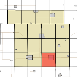
Union Township covers an area of 35.47 square miles (91.9 km2) and contains one incorporated settlement, Lohrville. According to the USGS, it contains two cemeteries: Evergreen and Evergreen.
References[]
- ^ "US Board on Geographic Names". United States Geological Survey. 2007-10-25. Retrieved 2008-01-31.
- ^ "U.S. Census website". United States Census Bureau. Retrieved 2008-01-31.
- ^ Stonebraker, Beaumont E. (1915). Past and Present of Calhoun County, Iowa: A Record of Settlement, Organization, Progress, and Achievement, Volume 1. Pioneer Publishing Company. p. 125.
External links[]
Municipalities and communities of Calhoun County, Iowa, United States | ||
|---|---|---|
| Cities | ||
| Townships | ||
| CDP | ||
| Other unincorporated communities | ||
| Footnotes | ‡This populated place also has portions in an adjacent county or counties | |
| ||
This article about the geography of Calhoun County, Iowa is a stub. You can help Wikipedia by . |
Categories:
- Townships in Calhoun County, Iowa
- Townships in Iowa
- Northwest Iowa geography stubs