Unley Park, South Australia
| Unley Park Adelaide, South Australia | |||||||||||||||
|---|---|---|---|---|---|---|---|---|---|---|---|---|---|---|---|
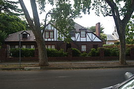 Residential home in the Tudorbethan architectural style | |||||||||||||||
| Population | 1,445 (2016 census)[1] | ||||||||||||||
| • Density | 1,810/km2 (4,680/sq mi) | ||||||||||||||
| Established | 1840[2] | ||||||||||||||
| Postcode(s) | 5061 | ||||||||||||||
| Area | 0.8 km2 (0.3 sq mi) | ||||||||||||||
| Location | 5.5 km (3 mi) S of Adelaide | ||||||||||||||
| LGA(s) | City of Unley | ||||||||||||||
| State electorate(s) | Unley | ||||||||||||||
| Federal Division(s) | Adelaide | ||||||||||||||
| |||||||||||||||
Unley Park is a southern suburb of Adelaide in the City of Unley. Its postcode is 5061.
It is located on the north side of Cross Road and east of the Belair railway line. Access via public transport is from the Unley Park railway station, Millswood railway station and the Unley Road "Go Zone".
A feature of the district is leafy Victoria Avenue—Adelaide's wealthiest street, containing many large and luxurious houses built between the two World Wars.[3]
Politically, the suburb is safe for the Liberals; at the 2010 election, the Liberal Party attracted 62.33% of the primary vote at the nearby Hyde Park polling booth.[4]
History[]
Unley Park Post Office opened on 2 January 1946 and closed in 1999.[5]
Two historic private schools were located on Thornber Street, Unley Park: Kyre College (which was the nucleus of Scotch College) at number 4, and Mrs. Thornber's School, later associated with Tormore House School, at number 39. Both were dissolved early in the 20th Century.
See also[]
References[]
- ^ Australian Bureau of Statistics (27 June 2017). "Unley Park (State Suburb)". 2016 Census QuickStats. Retrieved 30 July 2019.

- ^ "How Unley Developed". City of Unley. Archived from the original on 19 July 2008. Retrieved 19 February 2009.
- ^ Smart Company. "Report names Australia's richest streets". Retrieved 9 April 2009.
- ^ Australian Electoral Commission. "Polling Place - Hyde Park". Retrieved 4 June 2011.
- ^ Premier Postal History. "Post Office List". Premier Postal Auctions. Retrieved 26 May 2011.
| Authority control |
|
|---|
Coordinates: 34°57′40″S 138°36′00″E / 34.961°S 138.600°E

This article about a place in Adelaide is a stub. You can help Wikipedia by . |
- Suburbs of Adelaide
- Populated places established in 1840
- Adelaide geography stubs