Vallo di Nera
Vallo di Nera | |
|---|---|
| Comune di Vallo di Nera | |
 | |
 Coat of arms | |
show Location of Vallo di Nera | |
 Vallo di Nera Location of Vallo di Nera in Italy | |
| Coordinates: 42°45′N 12°52′E / 42.750°N 12.867°ECoordinates: 42°45′N 12°52′E / 42.750°N 12.867°E | |
| Country | Italy |
| Region | Umbria |
| Province | Perugia (PG) |
| Frazioni | Borbonea, Geppa, La Pieve, Le Campore, Meggiano, Monte Fiorello, Paterno, Piedilacosta, Piedipaterno, Roccagelli |
| Government | |
| • Mayor | Agnese Benedetti |
| Area | |
| • Total | 36.0 km2 (13.9 sq mi) |
| Elevation | 467 m (1,532 ft) |
| Population (2007)[3] | |
| • Total | 419 |
| • Density | 12/km2 (30/sq mi) |
| Demonym(s) | Vallani |
| Time zone | UTC+1 (CET) |
| • Summer (DST) | UTC+2 (CEST) |
| Postal code | 06040 |
| Dialing code | 0743 |
| Patron saint | St.Giovanni Battista |
| Saint day | 24 June |
| Website | Official website |


| Wikimedia Commons has media related to Vallo di Nera. |
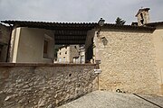
Vallo di Nera is a comune (municipality) in the Province of Perugia in the Italian region Umbria, located about 60 km southeast of Perugia.
- Images of Vallo di Nera

The church San Giovanni Battista

The church Santa Maria
The church San Rocco


References[]
- ^ "Superficie di Comuni Province e Regioni italiane al 9 ottobre 2011". Istat. Retrieved 16 March 2019.
- ^ "Popolazione Residente al 1° Gennaio 2018". Istat. Retrieved 16 March 2019.
- ^ All demographics and other statistics: Italian statistical institute Istat.
External links[]
| show Authority control |
|---|
This Umbria location article is a stub. You can help Wikipedia by . |
Categories:
- Cities and towns in Umbria
- Municipalities of the Province of Perugia
- Umbria geography stubs