Veii
Veio | |
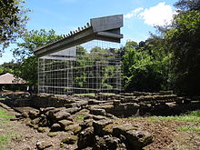 Ruins of the temple of Veii | |
 Shown within Italy | |
| Alternative name | Veius |
|---|---|
| Location | Isola Farnese, Province of Rome, Lazio, Italy |
| Region | Latium |
| Coordinates | 42°01′24″N 12°23′23″E / 42.02333°N 12.38972°ECoordinates: 42°01′24″N 12°23′23″E / 42.02333°N 12.38972°E |
| Type | Settlement |
| Area | 190 ha (470 acres) |
| History | |
| Events | Battle of Veii |
| Site notes | |
| Condition | Ruined |
| Ownership | Public |
| Management | Soprintendenza per i Beni Archeologici dell'Etruria Meridionale |
| Public access | Yes |
| Website | Area archeologica di Veio (in Italian) |

Veii (also Veius; Italian: Veio) was an important ancient Etruscan city situated on the southern limits of Etruria and only 16 km (9.9 mi) north-northwest of Rome, Italy. It now lies in Isola Farnese, in the comune of Rome. Many other sites associated with and in the city-state of Veii are in Formello, immediately to the north. Formello is named after the drainage channels that were first created by the Veians.
Veii was the richest city of the Etruscan League. It was alternately at war and in alliance with the Roman Kingdom and later Republic for over 300 years. It eventually fell in the Battle of Veii to Roman general Camillus's army in 396 BC. Veii continued to be occupied after its capture by the Romans.
The site is now a protected area, part of the Parco di Veio established by the regional authority of Lazio in 1997.[1]


Site[]
City of Veii[]
The city of Veii lies mainly on a tuff plateau 190 hectares (470 acres) in area.[2]
The Valchetta flows a few miles eastward to join the Tiber River on the south side of Labaro along the Via Flaminia and Veii's territory included this area.
Its proximity to the Tiber and the trade route to the interior, which became the Via Flaminia, augmented its prosperity but also placed it in competition with Rome for the domination of Latium.
The temple of Juno was the greatest and most honoured in the city.[3]
The largest visible monument is the sanctuary of Minerva from the 7th c. BC, situated along an important route just outside the city (at modern Portonaccio). The sanctuary was one of the oldest and most revered in Etruria, standing out for its sumptuous polychrome terracotta decorations, many of which can be seen today in the Villa Giulia. The sanctuary included the temple of Apollo of about 510 BC to which belonged the Apollo of Veii (now in the National Etruscan Museum).
The impressive thermal baths and the forum built under Augustus have been partially excavated in recent years.
Many rich Tumuli and chamber tombs have been found. The most famous is the Grotta Campana uncovered in 1843, a chamber tomb with the oldest known Etruscan frescoes.
There are also long tunnels leading into the plateau of the city, which may corroborate Livy's account of the Roman victory in the Battle of Veii.
The walls of Veii, of which small sections remain, bordered the two intersecting streams using the streambeds as a ditch, with a wall across the plateau closing the triangle.[4]
Piazza d'Armi[]
Every Etruscan stronghold was built on an elevation, and Veii was no exception. Its arx, or citadel, was placed on a bluff delineated by cliffs within the angle of confluence of the two streams, nearly separated from the main ridge by a gully, through which ran a road in the Roman period. An archaeological site, Piazza d'Armi ("military square"), marks the location today.
History[]
Early history[]
The earliest evidence of occupation by demographic analysis, including that of the cemeteries, dates from the 10th century BC in the Late Bronze Age.[2] Small settlements were scattered over a wider area than the plateau and the population of the plateau at Veii is estimated to have been stable at about 1,000.[2] In the 9th century BC, the Early Iron Age (Villanovan culture), the finds are localised to the plateau but appear to be associated with independent settlements, each with its own cemetery. Occupation gradually intensified in the 8th (remainder of Villanovan) and 7th () centuries BC, by conurbation of the settlements as the site assumed an urban appearance with city blocks in a grid pattern arranged around a central square containing a water cistern. That evidence suggests that the city of Veii was shaped into its classical form in the 7th century BC by a population, presumably Etruscan, first settling there in the 10th century BC.
The population of the early Veii practised both inhumation and cremation within the same family. The proportion was 50% in the 9th century BC, after a predomination of cremation (90%) earlier. In the 8th century, inhumation rose to 70%, which may be attributable to an influence from Latium, where inhumation prevailed in the 9th century BC.
During the 9th and 8th centuries BC, the population density and grave goods were on the increase: more and wealthier people and also more of a disparity in wealth: the rise of a richer class. In the 8th century BC, both the potter's wheel and writing were introduced from Greece. During the entire period, the settlements translocated around the plateau; however, a settlement (Casale del Fosso) maintained a cemetery to the north of the plateau continuously from the late 9th century BC to the early 6th century BC.
Conflict with Rome[]
The documented history of Veii, like that of all Italian cities in their early centuries, is sparse and unreliable.
According to Livy (writing 700 years later) the Fidenates and the Veientes were defeated in a war with Rome during the reign of Rome's mythical first king, Romulus, in the 8th century BC.[5]
Plutarch (writing even later in the 1st C. AD)[6] says of them:
The first (to oppose Romulus) were the Veientes, a people of Tuscany (the site is now in Lazio), who had large possessions, and dwelt in a spacious city; they took occasion to commence a war, by claiming Fidenae as belonging to them....[7]

Fidenae and Veii were said to have again been defeated by Rome in the 7th century BC during the reign of Rome's third king Tullus Hostilius.
In the 6th century BC Rome's sixth king Servius Tullius warred against Veii (after the expiry of an earlier truce) and the Etruscans. He is said to have shown valour in the campaign, and to have routed a great army of the enemy. The war helped him to cement his position at Rome.[8]
In 509 BC, after the overthrow of the Roman monarchy, the family of Tarquinius Superbus went into exile in Caere in Etruria. Tarquin sought to regain the throne, at first by the Tarquinian conspiracy and, when that failed, by force of arms. He convinced the cities of Tarquinii and Veii to support him, and led their armies against Rome in the Battle of Silva Arsia. The Roman army was victorious, and it is recorded by Livy that although the forces of Tarquinii fought well on the right wing, initially pushing back the Roman left wing, the Veientes on the left wing faltered and fled the battle, because they were accustomed to defeat at the hands of the Romans. After the loss of the battle the forces of Veii returned home.[9] Livy writes that later in 509 BC, consul Publius Valerius Publicola returned to fight the Veientes.[10]
The most famous king of Veii was Lars Tolumnus whose family was part of the Veientine aristocracy[11] and who instigated a war with Rome in 438 BC.[12] The nearby Roman colony of Fidenae revolted against Rome and allied itself with Veii, giving Tolumnus control of the Fidenate army. The Romans sent four envoys to demand an explanation but they were murdered. Rome declared war against Veii and sent with an army who won the battle but the Roman losses were so high that a state of emergency was declared. A subsequent fiercely-fought battle with Veii in 437 BC reinforced by a contingent from Falerii was indecisive until the tribune Aulus Cornelius Cossus unhorsed Tolumnus and killed him with his spear.
In 406 BC, Rome declared war against Veii, still powerful and well-fortified, and her allies Falerii and Capena which required the Romans to commence a siege lasting many years.[3] As Plutarch says:
Veii had been the capital of Etruria, not inferior to Rome, either in number of arms or multitude of soldiers, so that relying on her wealth and luxury, and priding herself upon her refinement and sumptuousness, she had engaged in many honourable contests with the Romans for glory and empire .......... as the city was furnished with all sorts of weapons, offensive and defensive, likewise with corn and all manner of provisions, they cheerfully endured a siege
After ten years, in 396 BC, the Romans appointed Camillus as dictator. After defeating both Falerii and Capena at Nepete, Camillus commanded the final strike against Veii. He dug into the soft tuff rock below the walls whilst distracting the Veiians with attacks on the walls and infiltrated the city's drainage system to emerge in the citadel, leading to their defeat.[13] Not interested in surrender but only in Veii's complete destruction, the Romans slaughtered the entire adult male population and made slaves of all the women and children. The plunder was very rich and extensive including the statue of Juno taken to Rome.
Camillus supported the patricians in opposing the plebeian plan to populate Veii with half of the city of Rome designed to resolve poverty and space issues. Camillus deliberately protracted the project until its abandonment.[14]
Roman and later history[]
The city was soon assimilated under Roman control and is termed "Roman Veii" as opposed to "Etruscan Veii" by scholarly literature. Under the empire the Romans called the city the Municipium Augustum Veiens. The city never recovered its former wealth or its population after the Roman conquest. Nevertheless, after Rome's defeat in the battle of the Allia, many Roman soldiers fled there, and a project was proposed for abandoning Rome for Veii; this project was successfully opposed by Camillus.[13]
The Romans built wealthy villas in the region and Livia had an estate there, according to Suetonius.
Veii was eventually abandoned after Roman times, and everything of value or utility was removed by anyone with access to the site. Finally it was filled and smoothed for ploughland and was forgotten until its rediscovery in the 17th century by the antiquarian Raffaello Fabretti.
Ager Veientanus[]
The territory of a city-state anywhere within the Roman domain was, in Roman legal terminology, an ager. The law made a number of fine distinctions, but by ager it meant primarily ager publicus, "public territory", the land belonging to the state, which in those times was primarily agricultural (ager is "field").[15] The ager Veientanus (i.e. of Veii) covered the entire region between the right bank of the lower Tiber river and the coast; that is all of southern Etruria. The northwest border was probably as far west as the Monti Sabatini and Lake Bracciano in the north.[16] In Etruscan times the ager Veiantanus shared the countryside with the Silva Ciminia, the remnant of an ancient forest, of which the Romans stood in superstitious dread.
The ager Veiantanus remained for the most part agrarian until it became evident after World War II that the city of Rome was going to expand into and develop that area as a suburb. Moreover, a new method of ploughing was turning over the soil a metre deep, destroying all surface evidence. John Bryan Ward-Perkins, then Director of the British School at Rome, set into motion the South Etruria Survey (1954–1968), which cataloged all the visible antiquities in the ager Veientanus. It was published in 1968.[17]
Nearly 30 years later, in 1997, the Italian government moved to protect a part of that area, creating the Veio Regional Natural Park of 14,984 hectares (37,030 acres) between the Via Cassia on the west, the Via Flaminia on the east, the Via Campagnanese on the north and the city of Rome on the south.[18] Within the park are the comuni of Campagnano di Roma, Castelnuovo di Porto, Formello, Magliano Romano, Mazzano Romano, Morlupo, Riano, Sacrofano and Municipio XX of the city of Rome.
See also[]
- Apollo of Veii
- Etruscan Civilization
- Lars Tolumnius
- Portonaccio (Veio)
- Roman Republic
- Silva Ciminia
- Roman-Etruscan Wars
References[]
- ^ "Parco di Veio". Nature, History and Archaeology in the Heart of Rome. Retrieved 14 January 2012.
- ^ Jump up to: a b c Bernardinetti, Alessandra; Santis, Anna de; Drago, Luciana (1997). "Burials as Evidence for Proto-Urban Development in Southern Etruria: the Case of Veii". In Andersen, Helle Damgaard (ed.). Urbanization in the Mediterranean in the 9th to 6th centuries BC (illustrated ed.). Copenhagen: Museum Tusculanum Press. pp. 317–342. ISBN 978-87-7289-412-6.
- ^ Jump up to: a b Plutarch: Camillus
- ^ Torelli, Mario (2000). "The Etruscan City-State". In Hansen, Mogens Herman (ed.). A comparative study of thirty city-state cultures. Copenhagen: Kongelige Danske Videnskabernes Selskab. p. 195. ISBN 978-87-7876-177-4.
- ^ Livy, Ab urbe condita, 1:14-15
- ^ Plutarch: Romulus
- ^ However this account differs from Livy's who refers to at least one war fought by Rome prior to the dispute with Veii, being the war with the Sabines and others arising out of the Rape of the Sabine Women
- ^ Livy Ab urbe condita 1.42
- ^ Livy, Ab urbe condita, 2.6-7
- ^ Livy, Ab urbe condita 2.8
- ^ C. J. Smith, The Roman Clan: The Gens from Ancient Ideology to Modern Anthropology, Cambridge University Press, ISBN 978-0-521-85692-8, pp. 161 ff
- ^ Livy, iv. 17
- ^ Jump up to: a b Chisholm, Hugh, ed. (1911). . Encyclopædia Britannica. 27 (11th ed.). Cambridge University Press. p. 969.
- ^ Boatwright, Mary (2006). A Brief History of the Romans. Oxford University Press.
- ^ William Smith, ed. (2009) [1875]. "Ager". A Dictionary of Greek and Roman Antiquities. London, Chicago: John Murray, University of Chicago.
- ^ Rich, John; Andrew Wallace-Hadrill (1992). City and country in the ancient world (reprint, illustrated ed.). Routledge. p. 198. ISBN 978-0-415-08223-5.
- ^ Kahane, Anne; Threipland, Leslie Murray; Ward-Perkins, John Bryan (1968). The Ager Veientanus, North and East of Rome. the British School at Rome.
- ^ "Veio Regional Natural Park". Parks and Protected Areas in the Lazio Region. agrinet. Archived from the original on 1 July 2002. Retrieved 15 June 2009.
Bibliography[]
- Dennis, George (2009) [1848]. "Chapter I Veii — The City". The Cities and Cemeteries of Etruria. London, Chicago: John Murray, LacusCurtius.
- "The Park of Veio: Our concern" (PDF). Parco Regionale di Veio. Archived from the original (pdf) on 22 July 2011. Retrieved 15 June 2009.
- Hemphill, Patricial (Winter 1970). "An Archaeological Survey of Southern Etruria" (pdf). Expedition. Retrieved 18 June 2009.
- Quilici, L., S. Quilici Gigli, R. Talbert, T. Elliott, S. Gillies. "Places: 423116 (Veii)". Pleiades. Retrieved March 7, 2012.CS1 maint: multiple names: authors list (link)
Further reading[]
- Boitani, Francesca, and Ugo Fusco. 2015. "A New Mithraic Relief from Veii." Archeologia Classica 66: 519–46.
- Cascino, Roberta, Helga Di Giuseppe, and Helen L. Patterson, eds. 2012. Veii: The Historical Topography of the Ancient City: A Restudy of John Ward-Perkins’s Survey. Archaeological Monographs of the British School at Rome 19. London: British School at Rome.
- Neils, Jenifer. 2008. "Niobe (?) on the Portonaccio Temple at Veii." Etruscan Studies 11, no. 1: 35–48. doi:10.1515/etst.2008.11.1.35
- Potter, T. W. 1979. The Changing Landscape of South Etruria. London: Paul Elek.
- Saviano, Giovanna, Luciana Drago, Ferdinando Felli, and Maurizio Violo. 2002. "Architectural Decorations, Ceramics and Terracottas from Veii (Etruria): A Preliminary Study." Periodico Di Mineralogia 71: 203–15.
- Scullard, H. H. 1967. The Etruscan Cities and Rome. Ithaca, NY: Cornell Univ. Press.
- Ward-Perkins, John Bryan. 1961. "Veii: The Historical Topography of the Ancient City." Papers of the British School at Rome 29, no. 16: 1–123.
External links[]
| Wikimedia Commons has media related to Veio. |
| Library resources about Veii |
- Official website (in Italian)
- Parco di Veio (in Italian)

| Authority control |
|
|---|
- Veii
- Etruscan cities
- Former populated places in Italy
- Archaeological sites in Rome
- National museums of Italy