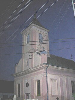
Vlajkovac
Vlajkovac
Влајковац | |
|---|---|
Village (Selo) | |
 The | |
 Vlajkovac Location of Vlajkovac within Serbia | |
| Coordinates: 45°04′17″N 21°12′01″E / 45.07139°N 21.20028°ECoordinates: 45°04′17″N 21°12′01″E / 45.07139°N 21.20028°E | |
| Country | Serbia |
| Province | Vojvodina |
| District | South Banat |
| Elevation | 80 m (260 ft) |
| Population (2002) | |
| • Vlajkovac | 1,178 |
| Time zone | UTC+1 (CET) |
| • Summer (DST) | UTC+2 (CEST) |
| Postal code | 26332 |
| Area code(s) | +381(0)13 |
| Car plates | VŠ |
Vlajkovac (Serbian Cyrillic: Влајковац) is a village in Serbia. It is situated in the Vršac municipality, in the South Banat District, Vojvodina province.
Name[]
In Serbian, the village is known as Vlajkovac (Влајковац), in Romanian as Vlaicovăț, in Hungarian as Temesvajkóc, and in German as Wlajkowatz.
History[]
Bronze Age graves of south Russian steppe nomads was found in the village.
Ethnic groups (2002 census)[]
The village has a Serb ethnic majority with a seizable Romanian and Hungarian minority and its population numbering 1,178 people (2002 census).[1]
- Serbs = 656 (55.68%)
- Romanians = 288 (24.44%)
- Hungarians = 182 (15.44%)
- Yugoslavs = 16
Population history[]

The DTD (Danube-Tisa-Danube) channel at village Vlajkovac.
- 1961: 1,855
- 1971: 1,530
- 1981: 1,356
- 1991: 1,328
- 2002: 1,178
See also[]
- List of places in Serbia
- List of cities, towns and villages in Vojvodina
References[]
- ^ Popis stanovništva, domaćinstava i stanova u 2002, Stranovništvo - nacionalna ili etnička pripadnost - podaci po naseljima, knjiga 1, Republika Srbija, Republički zavod za statistiku, Beograd, Februar 2003.
Further reading[]
- Slobodan Ćurčić, Broj stanovnika Vojvodine, Novi Sad, 1996.
| Wikimedia Commons has media related to Vlajkovac. |
Categories:
- Populated places in Serbian Banat
- Populated places in South Banat District
- Vršac


