Voda, Kansas
Voda, Kansas | |
|---|---|
 | |
 Voda | |
| Coordinates: 39°2′57″N 100°1′11″W / 39.04917°N 100.01972°WCoordinates: 39°2′57″N 100°1′11″W / 39.04917°N 100.01972°W | |
| Country | United States |
| State | Kansas |
| County | Trego |
| Elevation | 2,546 ft (776 m) |
| Time zone | UTC-6 (CST) |
| • Summer (DST) | UTC-5 (CDT) |
| Area code | 785 |
| FIPS code | 20-74125 |
| GNIS ID | 471360 |


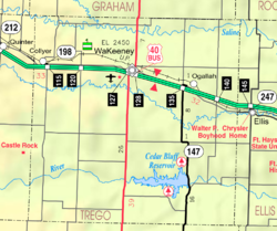
Voda is an unincorporated community in Trego County, Kansas, United States.[1] It is located approximately 7 miles west of WaKeeney.
History[]
A post office in Voda opened in 1904, closed in 1907, reopened in 1912, and closed permanently in 1913.[2]
References[]
- ^ "Trego County". Blue Skyways. Kansas State Library. Retrieved 27 June 2014.
- ^ "Kansas Post Offices, 1828-1961". Kansas Historical Society. Archived from the original on October 9, 2013. Retrieved 27 June 2014.
Further reading[]
External links[]
Municipalities and communities of Trego County, Kansas, United States | ||
|---|---|---|
| Cities |  | |
| Unincorporated communities | ||
| Ghost towns | ||
| Townships | ||
| Footnotes | †This populated place is designated a Census-Designated Place (CDP) by the United States Census Bureau. | |
| ||
Categories:
- Unincorporated communities in Trego County, Kansas
- Unincorporated communities in Kansas
- Kansas geography stubs