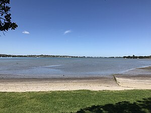
Wai o Taiki Bay
Wai o Taiki Bay | |
|---|---|
 Wai o Taiki Bay | |
 | |
| Country | New Zealand |
| City | Auckland Council |
| Electoral ward | Maungakiekie-Tāmaki Ward |
| Local board | Maungakiekie-Tāmaki Local Board |
| Board subdivision | Tamaki |
| Population (2018) | |
| • Total | 3,447 |
| Saint Heliers | Glendowie | |
| Glen Innes |
|
Tamaki River |
| Point England | Farm Cove | Half Moon Bay |
Wai o Taiki Bay is a suburb in Auckland, New Zealand. It is under the local governance of Auckland Council.
Location[]
Bordering Glen Innes, Glendowie and the Tamaki River estuary.
Demographics[]
| Year | Pop. | ±% p.a. |
|---|---|---|
| 2006 | 3,855 | — |
| 2013 | 3,537 | −1.22% |
| 2018 | 3,447 | −0.51% |
| Source: [1] | ||
The statistical area of Glen Innes East-Wai O Taiki Bay had a population of 3,447 at the 2018 New Zealand census, a decrease of 90 people (-2.5%) since the 2013 census, and a decrease of 408 people (-10.6%) since the 2006 census. There were 915 households. There were 1,725 males and 1,719 females, giving a sex ratio of 1.0 males per female. The median age was 29.3 years, with 900 people (26.1%) aged under 15 years, 858 (24.9%) aged 15 to 29, 1,434 (41.6%) aged 30 to 64, and 255 (7.4%) aged 65 or older.
Ethnicities were 39.7% European/Pākehā, 22.1% Māori, 46.0% Pacific peoples, 9.9% Asian, and 2.5% other ethnicities (totals add to more than 100% since people could identify with multiple ethnicities).
The proportion of people born overseas was 30.2%, compared with 27.1% nationally.
Although some people objected to giving their religion, 32.6% had no religion, 52.6% were Christian, and 9.2% had other religions.
Of those at least 15 years old, 489 (19.2%) people had a bachelor or higher degree, and 552 (21.7%) people had no formal qualifications. The median income was $22,500. The employment status of those at least 15 was that 1,125 (44.2%) people were employed full-time, 369 (14.5%) were part-time, and 189 (7.4%) were unemployed.[1]
History[]
Its name is based on the original name of the Tamaki River, Te Wai o Taiki, meaning "The Waters of Taiki". The name Taiki is a shortened form of Taikehu, the name of an ancestor of Ngāi Tai.[2] The suburb contains a mix of state houses and architecturally designed houses constructed by developers.[3][4]
It was formerly under Auckland City Council from 1989 until the merger of all of Auckland's councils into the 'super city' in 2010.
Landmarks and features[]
Tahuna Torea[]
Tahuna Torea is a unique, 25-hectare, wildlife reserve of mangrove lagoon and swampland sited on a long sandbank extending out into the Tamaki Estuary. Rich in Māori history as well as home to native birds and vegetation, Tahuna Torea means 'gathering place of the oystercatcher'. There are three main walking trails around the reserve that take around 1 hour 30 minutes, but you can enjoy a walk around the bush tracks or the lagoon in as little as 40 minutes.
Wai-O-Taiki Nature Reserve[]
Wai-O-Taiki Nature Reserve is a bushy reserve that runs along the Tamaki Estuary, with a track connecting it to the larger Tahuna Torea reserve. Set in a grassy area off Fernwood Place you'll find a brand new playground that suits a variety of ages. The playground is fully fenced and has a bark play surface for safety.
Education[]
Glenbrae Primary School is a coeducational full primary school (years 1-8) with a roll of 168 as of November 2021.[5][6]
Notes[]
- ^ a b "Statistical area 1 dataset for 2018 Census". Statistics New Zealand. March 2020. Glen Innes East-Wai O Taiki Bay (145800). 2018 Census place summary: Glen Innes East-Wai O Taiki Bay
- ^ "Tahuna Torea". Auckland Council. Retrieved 22 November 2015.
- ^ "Glen Innes/Pt England: An exclusive extract". The New Zealand Herald. 25 March 2006.
- ^ "Wai O Taiki Waterside". Creating Communities. Retrieved 13 February 2018.
- ^ "New Zealand Schools Directory". New Zealand Ministry of Education. Retrieved 22 December 2021.
- ^ Education Counts: Glenbrae Primary School
Coordinates: 36°52′18″S 174°52′39″E / 36.871701°S 174.877532°E

- Suburbs of Auckland
- Populated places on the Tāmaki River