Wake Village, Texas
Wake Village, Texas | |
|---|---|
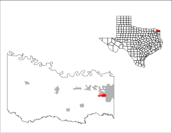
 Location of Wake Village, Texas | |
 | |
| Coordinates: 33°25′33″N 94°6′42″W / 33.42583°N 94.11167°WCoordinates: 33°25′33″N 94°6′42″W / 33.42583°N 94.11167°W | |
| Country | United States |
| State | Texas |
| County | Bowie |
| Area | |
| • Total | 2.99 sq mi (7.75 km2) |
| • Land | 2.99 sq mi (7.75 km2) |
| • Water | 0.00 sq mi (0.00 km2) |
| Elevation | 341 ft (104 m) |
| Population (2010) | |
| • Total | 5,492 |
| • Estimate (2019)[2] | 5,327 |
| • Density | 1,779.23/sq mi (686.96/km2) |
| Time zone | UTC-6 (Central (CST)) |
| • Summer (DST) | UTC-5 (CDT) |
| ZIP code | 75501 |
| Area code(s) | 903 |
| FIPS code | 48-76096[3] |
| GNIS feature ID | 1370739[4] |
| Website | wakevillagetx |

Wake Village is a city in Bowie County, Texas, United States, and a suburb of Texarkana, Texas. It is part of the Texarkana metropolitan area. The population was 5,492 at the 2010 census.[5]
History[]
Wake Village was founded in 1944 for the war effort to provide housing for the plant workers at the Red River Army Depot and the Lone Star Army Ammunition Plant.
The name came from Wake Island in the Pacific theater of the war. The population was over 1,000 in the early 1950s; in the early 1990s it had reached 4,400, and the 2000 census reported 5,129. The sections of Wake Village in which the original post-war homes exist are named WWII=related names ie Manila, Guam, Singapore, Arizona, Burma Victory, and so forth. The 1950s mid-century modern home enclaves feature names such as Esther and Marianna.
Geography[]
Wake Village is located in eastern Bowie County at 33°25′33″N 94°6′42″W / 33.42583°N 94.11167°W (33.425701, -94.111716),[6] immediately west of Texarkana, at the intersection of Farm to Market Road 989 and Old Redwater Road, north of U.S. Route 67 and south of U.S. Route 82. The city of Nash is situated immediately to the north, also along FM 989.
According to the United States Census Bureau, the city has a total area of 2.3 square miles (6.0 km2), all of it land.[5]
Demographics[]
| Historical population | |||
|---|---|---|---|
| Census | Pop. | %± | |
| 1950 | 1,066 | — | |
| 1960 | 1,140 | 6.9% | |
| 1970 | 2,408 | 111.2% | |
| 1980 | 3,865 | 60.5% | |
| 1990 | 4,757 | 23.1% | |
| 2000 | 5,129 | 7.8% | |
| 2010 | 5,492 | 7.1% | |
| 2019 (est.) | 5,327 | [2] | −3.0% |
| U.S. Decennial Census[7] | |||
As of the census[3] of 2000, there were 5,129 people, 2,042 households, and 1,511 families residing in the city. The population density was 3,092.9 people per square mile (1,193.0/km2). There were 2,198 housing units at an average density of 1,325.4/sq mi (511.2/km2). The racial makeup of the city was 82.76% White, 14.19% African American, 0.92% Native American, 0.47% Asian, 0.04% Pacific Islander, 0.96% from other races, and 0.66% from two or more races. Hispanic or Latino of any race were 3.18% of the population.
There were 2,042 households, out of which 34.4% had children under the age of 18 living with them, 58.7% were married couples living together, 12.1% had a female householder with no husband present, and 26.0% were non-families. 23.3% of all households were made up of individuals, and 8.2% had someone living alone who was 65 years of age or older. The average household size was 2.51 and the average family size was 2.94.
In the city, the population was spread out, with 25.8% under the age of 18, 8.4% from 18 to 24, 30.0% from 25 to 44, 22.7% from 45 to 64, and 13.0% who were 65 years of age or older. The median age was 36 years. For every 100 females, there were 90.7 males. For every 100 females age 18 and over, there were 87.3 males.
The median income for a household in the city was $39,961, and the median income for a family was $47,474. Males had a median income of $32,486 versus $20,648 for females. The per capita income for the city was $18,447. About 8.3% of families and 12.2% of the population were below the poverty line, including 19.8% of those under age 18 and 10.1% of those age 65 or over.
References[]
- ^ "2019 U.S. Gazetteer Files". United States Census Bureau. Retrieved August 7, 2020.
- ^ a b "Population and Housing Unit Estimates". United States Census Bureau. May 24, 2020. Retrieved May 27, 2020.
- ^ a b "U.S. Census website". United States Census Bureau. Retrieved 2008-01-31.
- ^ "US Board on Geographic Names". United States Geological Survey. 2007-10-25. Retrieved 2008-01-31.
- ^ a b "Geographic Identifiers: 2010 Demographic Profile Data (G001): Wake Village city, Texas". U.S. Census Bureau, American Factfinder. Archived from the original on February 12, 2020. Retrieved April 16, 2014.
- ^ "US Gazetteer files: 2010, 2000, and 1990". United States Census Bureau. 2011-02-12. Retrieved 2011-04-23.
- ^ "Census of Population and Housing". Census.gov. Retrieved June 4, 2015.
External links[]
Municipalities and communities of Bowie County, Texas, United States | ||
|---|---|---|
| Cities |  | |
| Unincorporated communities | ||
| Footnotes | ‡This populated place also has portions in an adjacent county or counties | |
| ||
- Cities in Bowie County, Texas
- Cities in Texas
- Texarkana
- Cities in Texarkana metropolitan area