Wales Airport (Maine)
Wales Airport | |||||||||||
|---|---|---|---|---|---|---|---|---|---|---|---|
| Summary | |||||||||||
| Airport type | Public use | ||||||||||
| Owner | Thomas P. O'Connell | ||||||||||
| Serves | Wales, Maine | ||||||||||
| Elevation AMSL | 210 ft / 64 m | ||||||||||
| Coordinates | 44°10′28″N 070°01′08″W / 44.17444°N 70.01889°WCoordinates: 44°10′28″N 070°01′08″W / 44.17444°N 70.01889°W | ||||||||||
| Map | |||||||||||
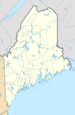 ME6 Location of airport in Maine | |||||||||||
| Runways | |||||||||||
| |||||||||||
| Statistics (2010) | |||||||||||
| |||||||||||

Wales Airport (FAA LID: ME6) is a privately owned, public use airport located two nautical miles (4 km) south-southwest of the central business district of Wales, a town in Androscoggin County, Maine, United States.[1]
Facilities and aircraft[]
Wales Airport covers an area of 500 acres (202 ha) at an elevation of 210 feet (64 m) above mean sea level. It has one runway designated 4/22 with a turf surface measuring 2,100 by 80 feet (640 x 24 m).[1]
For the 12-month period ending December 31, 2010, the airport had 300 general aviation aircraft operations, an average of 25 per month.[1]
References[]
- ^ a b c d FAA Airport Form 5010 for ME6 PDF. Federal Aviation Administration. Effective November 15, 2012.
External links[]
- Aerial image as of May 1998 from USGS The National Map
- Resources for this airport:
- FAA airport information for ME6
- AirNav airport information for ME6
- FlightAware airport information and live flight tracker
- SkyVector aeronautical chart for ME6
Categories:
- Airports in Androscoggin County, Maine