Wanla
Wanla | |
|---|---|
Village | |
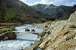 Yapola River in Wanla | |
 Wanla Location in Ladakh, India | |
| Coordinates: 34°14′56″N 76°49′48″E / 34.249013°N 76.829914°ECoordinates: 34°14′56″N 76°49′48″E / 34.249013°N 76.829914°E | |
| Country | India |
| Union Territory | Ladakh |
| District | Leh |
| Tehsil | Khalsi |
| Population (2011) | |
| • Total | 1,015 |
| Time zone | UTC+5:30 (IST) |
| Census code | 954 |


Wanla is a village in the Leh district of Ladakh, India.[1] It is located in the Khalsi tehsil, on the banks of the Yapola River (also known as the Wanla river). The Wanla Monastery is located in this village.
Demographics[]
According to the 2011 census of India, Wanla has 170 households. The effective literacy rate (i.e. the literacy rate of population excluding children aged 6 and below) is 63.81%.[2]
| Total | Male | Female | |
|---|---|---|---|
| Population | 1015 | 518 | 497 |
| Children aged below 6 years | 106 | 57 | 49 |
| Scheduled caste | 0 | 0 | 0 |
| Scheduled tribe | 1014 | 517 | 497 |
| Literates | 580 | 327 | 253 |
| Workers (all) | 529 | 266 | 263 |
| Main workers (total) | 317 | 248 | 69 |
| Main workers: Cultivators | 196 | 159 | 37 |
| Main workers: Agricultural labourers | 2 | 1 | 1 |
| Main workers: Household industry workers | 2 | 2 | 0 |
| Main workers: Other | 117 | 86 | 31 |
| Marginal workers (total) | 212 | 18 | 194 |
| Marginal workers: Cultivators | 190 | 7 | 183 |
| Marginal workers: Agricultural labourers | 3 | 0 | 3 |
| Marginal workers: Household industry workers | 1 | 0 | 1 |
| Marginal workers: Others | 18 | 11 | 7 |
| Non-workers | 486 | 252 | 234 |
References[]
- ^ "Blockwise Village Amenity Directory" (PDF). Ladakh Autonomous Hill Development Council. Retrieved 23 July 2015.
- ^ a b "Leh district census". 2011 Census of India. Directorate of Census Operations. Retrieved 23 July 2015.
Capital: Kargil; Leh | |||||||||||||||||||
| State symbols |
| ||||||||||||||||||
| History |
| ||||||||||||||||||
| Administration |
| ||||||||||||||||||
| Geography |
| ||||||||||||||||||
| Human settlements | |||||||||||||||||||
| Culture |
| ||||||||||||||||||
| Tourism and wildlife |
| ||||||||||||||||||
| Transport |
| ||||||||||||||||||
| Infrastructure |
| ||||||||||||||||||
| See also |
| ||||||||||||||||||
Categories:
- Villages in Khalsi tehsil