Warsill
| Warsill | |
|---|---|
 Warsill Hall Farm | |
 | |
| Population | 70 (2015) |
| OS grid reference | SE226651 |
| Civil parish |
|
| District |
|
| Shire county | |
| Region | |
| Country | England |
| Sovereign state | United Kingdom |
| Post town | HARROGATE |
| Postcode district | HG3 |
| Police | North Yorkshire |
| Fire | North Yorkshire |
| Ambulance | Yorkshire |
| UK Parliament | |

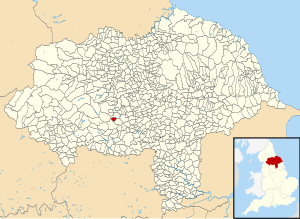
Warsill is a settlement and civil parish in the Harrogate district, in the county of North Yorkshire, England. It consists of a few scattered farms 5 miles (8 km) north west of Ripon. In 1961 the population of the parish was 42.[1] The population was estimated at 70 in 2015.[2]
Warsill was historically an extra parochial area. It became a civil parish in 1858.[3] Today it shares a grouped parish council with Bishop Thornton.[4]
The toponym, first recorded in 1132 as Warthsala, probably derives from the Old English weard sæl, meaning "watch castle".[5] In the Middle Ages there was a grange of Fountains Abbey here, and Warsill Hall Farmhouse, a 17th-century Grade II listed building, now stands on its site.[6]
References[]
- ^ Vision of Britain: Census Reports
- ^ "Population Estimates". North Yorkshire County Council. 2015. Retrieved 7 April 2017. In the 2011 census the population of the parish was included with Hartwith cum Winsley and not counted separately.
- ^ Vision of Britain website
- ^ Bishop Thornton, Shaw Mills and Warsill Parish Web Portal
- ^ Smith, A.H. (1961). The Place-names of the West Riding of Yorkshire. Vol. 5. Cambridge University Press. p. 186.
- ^ Historic England. "Details from listed building database (1251860)". National Heritage List for England. Retrieved 7 April 2017.
| Wikimedia Commons has media related to Warsill. |
Categories:
- Villages in North Yorkshire
- Civil parishes in North Yorkshire
- Borough of Harrogate