Wase, Nigeria
Wase | |
|---|---|
LGA and town | |
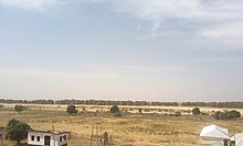
 City view of Wase Rock | |
 Wase | |
| Coordinates: 9°6′N 9°58′E / 9.100°N 9.967°E | |
| Country | Nigeria |
| State | Plateau State |
| Headquarters | Wase |
| Area | |
| • Land | 1,663 sq mi (4,306 km2) |
| Population (2016) | |
| • Total | 209,400 |
| • Density | 107.8/sq mi (41.62/km2) |
| Time zone | UTC+1 (WAT) |
| Website | https://www.plateaustate.gov.ng/page/wase |

Wase is a town and Local Government Area (LGA) of Plateau State, Nigeria, situated some 216 km south east of Jos, the Plateau State capital. It shares its name with the nearby Wase River. The population of the LGA was 159,861 people as of 2006, with an urban area of 1750 km².[1]
History[]
The region of Wase was founded around 1820 by a Fulani official in Bauchi, centered around the traditional walled town of the same name. At first, it served as a chiefdom ruled by the Jukun and Tarok and was predominantly inhabited by the Tarok,[2][3] and Basherawa, but it later became part of the British Royal Niger Company protectorate (later Northern Nigeria) following the arrival of British troops in 1898. Wase was a part of Plateau Province when it was established in 1926, and then Plateau State upon Nigerian Independence in 1960.
Environment[]
Around 321 hectares (790 acres) of land around Wase is conserved for wildlife development and serves as a bird sanctuary - local species include the Rossy White Pelican. The protected land includes Wase Rock, a massive dome-shaped inselberg of volcanic origin standing at 350m in height,[4] making it visible from a distance of some 40 km (25 miles).
The region is renowned for its mining activities due to a high concentration of lead, zinc, tin and other minerals. This has attracted considerable interest from Chinese investors who have constructed few local bridges and other infrastructure close to Wase's mining sites, although these services have not always reached the local community.[5]
Population[]
The 2006 census population of Wase LGA was 159,861. There is a near-equal gender distribution (50.3% male) and a predominantly youthful population - 47.3% are younger than 15, whereas only 2.7% are aged 65 and over. The ethnic groups in Wase are the Hausa/Fulanis, Yankam, Tarok, Jukuns, and Boghoms. The major religions are Islam, Christianity, and the traditional African religion.
Local government council[]
The main tribal groups in the local council are the Fulani people ruled by an Emir, (Yankam) Basharawa people ruled by the Rekna, who use the Yankham language, and the Tarok ruled by Ponzhi. Emirs are selected by a council of seven kingmakers. The 13th Emir of Wase was Alhaji (Dr.) Haruna Abdullahi Maikano. He was nominated three months after the death of his father in September 2001, although this was not confirmed until the following year.[6] He was assisted by the Rekna of Bashar, Alh. Adamu Idris, in conducting the affairs of the traditional council, who rule in the absence of the emir. Haruna Abdullah died in September 2010 at the age of 64.[7] Alh Dr Muhammadu Sambo Haruna replaced late Dr Haruna Abdullah as the 14th Emir of Wase with effect from 28 October 2010.[8]
Political Division of Wase[]
Administratively, Wase was divided into four districts, namely: Wase, Bashar, Lamba, and Kadarko. Each of these districts is headed by a district head known as the "Hakimi", while the various towns and villages in the districts are headed by a chief known as "Sarki". Currently the Rekna of Bashar is the oldest paramount traditional ruler.
References[]
- ^ http://www.plateaustate.gov.ng/page/wase
- ^ Administrator, O'Tarok. "Tarok History :: A Brief Historical Background". OTarok. Retrieved 5 March 2021.
- ^ E. N., Lamle. "Origin, Migration and Clan Structure of the Tarok People: Tree in the Forest Mandyeng". Journal of Central Nigeria Studies: 25–56.
- ^ https://zodml.org/discover-nigeria/heritage-and-culture/wase-rock#.WvsygaQvzIU
- ^ https://www.dailytrust.com.ng/news/general/inside-closure-of-plateau-s-juiciest-mining-site/211611.html
- ^ "Nigeria: Six Eye Wase Emir's Throne". Daily Trust. 23 September 2010. Retrieved 2012-03-24.
- ^ GONJI PALANG (18 September 2010). "Nigeria: Emir of Wase Dies at 64". Leadership (Abuja). Retrieved 2012-03-24.
- ^ MAHMUD LALO (29 October 2010). "Nigeria: Wase Gets New Emir". Daily Trust. Retrieved 2012-03-24.
Coordinates: 9°06′N 9°58′E / 9.100°N 9.967°E
State capital: Jos | ||
| Local Government Areas |  | |
- Populated places in Plateau State
- Local Government Areas in Plateau State