Waverly, South Dakota
Waverly, South Dakota | |
|---|---|
 Waverly Location in South Dakota | |
| Coordinates: 44°59′57″N 96°58′16″W / 44.99917°N 96.97111°WCoordinates: 44°59′57″N 96°58′16″W / 44.99917°N 96.97111°W | |
| Country | United States |
| State | South Dakota |
| County | Codington |
| Area | |
| • Total | 1.0 sq mi (2.6 km2) |
| • Land | 1.0 sq mi (2.6 km2) |
| • Water | 0 sq mi (0 km2) |
| Elevation | 1,985 ft (605 m) |
| Population (2010) | |
| • Total | 37 |
| • Density | 36/sq mi (14.0/km2) |
| Time zone | UTC-6 (Central (CST)) |
| • Summer (DST) | UTC-5 (CDT) |
| Area code(s) | 605 |
| FIPS code | 46-69420[1] |
| GNIS feature ID | 1258847[2] |

Waverly is an unincorporated community and census-designated place (CDP) in Codington County, South Dakota, United States. The population was 37 at the 2010 census.[1]
The community derives its name from the Waverley Novels.[3]
Geography[]
Waverly is located in eastern Codington County 15 miles (24 km) northeast of Watertown, the county seat. It is 4 miles (6 km) east of Exit 185 on Interstate 29.
According to the United States Census Bureau, the Waverly CDP has a total area of 1.0 square mile (2.6 km2), all land.[1]
References[]
- ^ a b c "Geographic Identifiers: 2010 Census Summary File 1 (G001): Waverly CDP, South Dakota". U.S. Census Bureau, American Factfinder. Archived from the original on February 13, 2020. Retrieved July 2, 2015.
- ^ "US Board on Geographic Names". United States Geological Survey. July 2, 2015. Retrieved July 2, 2015.
- ^ Federal Writers' Project (1940). South Dakota place-names, v.1-3. University of South Dakota. p. 68.
Municipalities and communities of Codington County, South Dakota, United States | ||
|---|---|---|
| City | 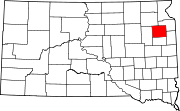 | |
| Towns | ||
| CDP | ||
| Other communities | ||
| Indian reservation | ||
| Footnotes | ‡This populated place also has portions in an adjacent county or counties | |
| ||
Categories:
- Census-designated places in Codington County, South Dakota
- Census-designated places in South Dakota