Wayne Township, Jay County, Indiana
This article needs additional citations for verification. (March 2013) |
Wayne Township | |
|---|---|
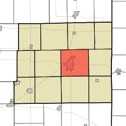 Location in Jay County | |
| Coordinates: 40°26′10″N 84°57′35″W / 40.43611°N 84.95972°WCoordinates: 40°26′10″N 84°57′35″W / 40.43611°N 84.95972°W | |
| Country | United States |
| State | Indiana |
| County | Jay |
| Area | |
| • Total | 37.14 sq mi (96.2 km2) |
| • Land | 37.14 sq mi (96.2 km2) |
| • Water | 0 sq mi (0 km2) 0% |
| Elevation | 902 ft (275 m) |
| Population (2010) | |
| • Total | 7,918 |
| • Density | 213.2/sq mi (82.3/km2) |
| GNIS feature ID | 0454033 |

Wayne Township is one of twelve townships in Jay County, Indiana, United States. As of the 2010 census, its population was 7,918 and it contained 3,748 housing units.[1]
History[]
Wayne Township was organized in 1837.[2]
Floral Hall was listed on the National Register of Historic Places in 1983.[3]
Geography[]
According to the 2010 census, the township has a total area of 37.14 square miles (96.2 km2), all land.[1] The streams of Butternut Creek, Elm Brook, Golf Brook, Hearne Run, Little Salamonie River, Millers Branch, Race Run and Saw Run run through this township.
Cities and towns[]
- Portland (the county seat)
Unincorporated towns[]
Adjacent townships[]
- Bearcreek Township (north)
- Noble Township (east)
- Madison Township (southeast)
- Pike Township (south)
- Jefferson Township (southwest)
- Greene Township (west)
- Jackson Township (northwest)
Cemeteries[]
The township contains five cemeteries: Green Park, Hearne, Jaque, Liber and Reed.
Major highways[]
Airports and landing strips[]
- Steed Field
References[]
- ^ a b "Population, Housing Units, Area, and Density: 2010 - County -- County Subdivision and Place -- 2010 Census Summary File 1". United States Census. Archived from the original on 2020-02-12. Retrieved 2013-05-10.
- ^ Jay, Milton T. (1922). History of Jay County, Indiana: Including Its World War Record and Incorporating the Montgomery History, Volume 1. Historical Publishing Company. p. 104.
- ^ "National Register Information System". National Register of Historic Places. National Park Service. July 9, 2010.
External links[]
Municipalities and communities of Jay County, Indiana, United States | ||
|---|---|---|
| Cities | ||
| Towns | ||
| Townships | ||
| Unincorporated communities | ||
| Footnotes | ‡This populated place also has portions in an adjacent county or counties | |
| ||
Categories:
- Townships in Jay County, Indiana
- Townships in Indiana