Wayne Township, Tippecanoe County, Indiana
Wayne Township | |
|---|---|
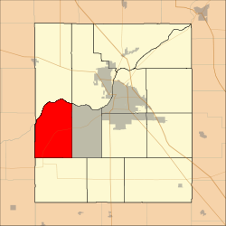 Location in Tippecanoe County | |
| Coordinates: 40°21′15″N 87°02′27″W / 40.35417°N 87.04083°WCoordinates: 40°21′15″N 87°02′27″W / 40.35417°N 87.04083°W | |
| Country | United States |
| State | Indiana |
| County | Tippecanoe |
| Government | |
| • Type | Indiana township |
| Area | |
| • Total | 34.63 sq mi (89.7 km2) |
| • Land | 34.28 sq mi (88.8 km2) |
| • Water | 0.35 sq mi (0.9 km2) 1.01% |
| Elevation | 617 ft (188 m) |
| Population (2010) | |
| • Total | 1,580 |
| • Density | 46.1/sq mi (17.8/km2) |
| Time zone | UTC-5 (Eastern (EST)) |
| • Summer (DST) | UTC-4 (EDT) |
| ZIP codes | 47906, 47909, 47918, 47992 |
| Area code(s) | 765 |
| GNIS feature ID | 454041 |

Wayne Township is one of thirteen townships in Tippecanoe County, Indiana, United States. As of the 2010 census, its population was 1,580 and it contained 623 housing units.[2]
Geography[]

The Wabash River forms the township's northern border. Photo looks toward the extinct communities of Ouiatenon and Granville.
According to the 2010 census, the township has a total area of 34.63 square miles (89.7 km2), of which 34.28 square miles (88.8 km2) (or 98.99%) is land and 0.35 square miles (0.91 km2) (or 1.01%) is water.[2]
Unincorporated communities[]
- Glenhall at 40°21′15″N 87°02′27″W / 40.3542030°N 87.0408434°W
- Westpoint at 40°20′42″N 87°02′35″W / 40.3450364°N 87.0430655°W
(This list is based on USGS data and may include former settlements.)
Adjacent townships[]
- Shelby Township (north)
- Wabash Township (northeast)
- Union Township (east)
- Jackson Township (south)
- Davis Township, Fountain County (southwest)
- Warren Township, Warren County (west)
Cemeteries[]
The township contains these three cemeteries: Granville, Marks and Sherry.
Major highways[]
School districts[]
- Tippecanoe School Corporation
Political districts[]
- Indiana's 4th congressional district
- State House District 41
- State Senate District 22
References[]
- ^ "US Board on Geographic Names". United States Geological Survey. October 25, 2007. Retrieved 2017-05-09.
- ^ a b "Population, Housing Units, Area, and Density: 2010 - County -- County Subdivision and Place -- 2010 Census Summary File 1". United States Census. Retrieved 2013-05-10.
External links[]
Municipalities and communities of Tippecanoe County, Indiana, United States | ||
|---|---|---|
| Cities | ||
| Towns | ||
| Townships | ||
| CDPs | ||
| Other communities |
| |
| Ghost towns | ||
| Footnotes | ‡This populated place also has portions in an adjacent county or counties | |
| ||
Categories:
- Townships in Tippecanoe County, Indiana
- Lafayette metropolitan area, Indiana
- Townships in Indiana