Wearside
This article needs additional citations for verification. (August 2007) |
Wearside | |
|---|---|
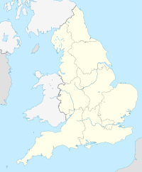 Wearside Location of Wearside in England | |
| Coordinates: 54°54′14″N 1°22′52″W�� / 54.90389°N 1.38111°WCoordinates: 54°54′14″N 1°22′52″W / 54.90389°N 1.38111°W | |
| Sovereign state | United Kingdom |
| Country | England |
| Region | North East |
| Population (2011) | |
| • Total | 335,415 |
| Time zone | GMT (UTC) |
| • Summer (DST) | UTC+1 (BST) |

Wearside (/ˈwɪərsaɪd/) is a conurbation of North East England centred on the continuous urban area of Sunderland by the River Wear. It includes nearby separate significant settlements such as Washington, Houghton-le-Spring and Chester-Le-Street as well as the many settlements which form part of the continuous urban area, including Whitburn, Hetton-le-Hole, Bournmoor, South Hetton, Springwell Village, Ouston and Pelton. Therefore, Wearside is partially situated in both the metropolitan county of Tyne and Wear and the unitary authority district of County Durham.[1] Most of the Wearside areas is within the metropolitan borough of the City of Sunderland, which had a population of 280,807 in 2001.[2]
Economy[]
Like other parts of the North East, Wearside and Sunderland were economically structured by the primary and secondary sector of the economy; with a great deal of the economy once dependent on ship building at Sunderland Docks and coal mining with large collieries such as Monkwearmouth Colliery, which declined rapidly during the mid 20th century, many areas have long been deprived with vast areas of unemployment as a result. The city of Sunderland and parts of Wearside have been slowly rejuvenated over the years and industry is now largely based around call centres, although many areas such as Easington Colliery still face social problems today.
Media[]
Serving Wearside, the Sunderland Echo newspaper is sold throughout the area and online. Local commercial radio is broadcast by 103.4 Sun FM for Wearside and 107 Spark FM for the City of Sunderland.
Sport[]
The Wearside Football League is one of the levels in the English football league system and contains amateur teams such as Easington Colliery A.F.C. and Seaham Red Star F.C.. The only professional football team located in the area is Sunderland A.F.C., a team based in Sunderland.
Sub-divisions[]

According to the ONS definition the Wearside Built-up area (previously "Urban area") had the following subdivisions. Note that these are "Built-up areas subdivisions" as defined by the Office for National Statistics and will have different boundaries from the settlements after which they are named.[3]
| # | Sub-area name | Population (2011) |
|---|---|---|
| 1 | Sunderland | 174,286 |
| 2 | Washington | 67,085 |
| 3 | Chester-le-Street | 37,164 |
| 4 | Houghton-le-Spring | 13,863 |
| 5 | Hetton-le-Hole | 12,127 |
| 6 | Fence Houses | 6,649 |
| 7 | Ouston | 5,303 |
| 8 | Pelton | 5,278 |
| 9 | Whitburn | 5,102 |
| 10 | South Hetton | 3,032 |
| 11 | Bournmoor | 2,082 |
| 12 | Springwell | 2,074 |
| 13 | Whitehill | 1,370 |
| – | Total | 335,415 |
References[]
- ^ "2011 Census – Built-up areas". ONS. Retrieved 3 July 2013.
- ^ [1] Sunderland Statistics-source-Govt of UK
- ^ "2011 Built-up Areas - Methodology and Guidance" (PDF). Office for National Statistics. 2013. Retrieved 26 August 2021.
External links[]
This England-related article is a stub. You can help Wikipedia by . |
This Tyne and Wear location article is a stub. You can help Wikipedia by . |
- Urban areas of England
- Geography of County Durham
- City of Sunderland
- England stubs
- Tyne and Wear geography stubs
- Geography of Tyne and Wear