Weaver, Kansas
Weaver, Kansas | |
|---|---|
 | |
 Weaver | |
| Coordinates: 38°57′43″N 95°04′01″W / 38.96194°N 95.06694°WCoordinates: 38°57′43″N 95°04′01″W / 38.96194��N 95.06694°W | |
| Country | United States |
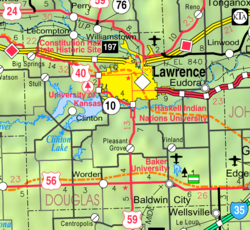
| State | Kansas |
| County | Douglas |
| Elevation | 1,089 ft (332 m) |
| Population | |
| • Estimate () | 0 |
| Time zone | UTC-6 (CST) |
| • Summer (DST) | UTC-5 (CDT) |
| Area code | 785 |
| GNIS ID | 484879 [1] |


Weaver is a ghost town in Douglas County, Kansas, United States.[2]
History[]
A post office called Weaver was established in 1891, and remained in operation until 1903. The Weaver community was located close to the southern bank of the Kansas River. The area lies in a region called "Weaver Bottoms," which is in the Kansas River floodplain. Therefore, the community was the victim of frequent flooding. Floods in 1903 and 1908 significantly damaged the community. The Great Flood of 1951 destroyed every remnant of the community, and forced all residents to leave the community permanently. No trace of Weaver exists as of 2021.
References[]
- ^ "US Board on Geographic Names". United States Geological Survey. October 25, 2007. Retrieved January 31, 2008.
- ^ U.S. Geological Survey Geographic Names Information System: Weaver, Kansas
Further reading[]
External links[]
Municipalities and communities of Douglas County, Kansas, United States | ||
|---|---|---|
| Cities |  | |
| Unincorporated communities | ||
| Ghost towns | ||
| Townships | ||
| ||
Categories:
- Unincorporated communities in Douglas County, Kansas
- Unincorporated communities in Kansas
- Kansas geography stubs