West Virginia Route 32
 | ||||
|---|---|---|---|---|
| Route information | ||||
| Maintained by WVDOH | ||||
| Length | 21.8 mi[1] (35.1 km) | |||
| Existed | 1932–present | |||
| Major junctions | ||||
| South end | ||||
| North end | ||||
| Location | ||||
| Counties | Randolph, Tucker | |||
| Highway system | ||||
| ||||
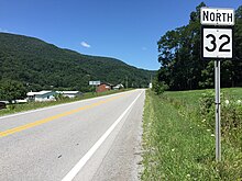
View north along WV 32 at US 33/WV 55 in Harman
West Virginia Route 32 is a north–south state highway connecting Randolph County and Tucker County in the northeastern portion of the U.S. state of West Virginia. The southern terminus is at U.S. Route 33 and West Virginia Route 55 in Harman. The northern terminus is at U.S. Route 219 in Thomas. The highway was built in 1932.
Major intersections[]
| County | Location | mi | km | Destinations | Notes |
|---|---|---|---|---|---|
| Randolph | Harman | 0.00 | 0.00 | Southern terminus | |
| Tucker | | ||||
| Davis | |||||
| Proposed junction[2] | |||||
| Thomas | 21.8 | 35.1 | Northern terminus | ||
1.000 mi = 1.609 km; 1.000 km = 0.621 mi
| |||||
References[]
- ^ Distance calculated using Microsoft MapPoint mapping software.
- ^ "The Route - Entire Map". West Virginia Corridor H. West Virginia Division of Highways. March 31, 2017. Retrieved June 10, 2017.
| Wikimedia Commons has media related to West Virginia Route 32. |
This West Virginia road or road transport-related article is a stub. You can help Wikipedia by . |
Categories:
- State highways in West Virginia
- Transportation in Randolph County, West Virginia
- Transportation in Tucker County, West Virginia
- West Virginia road stubs