Westfield Township, Tioga County, Pennsylvania
Westfield Township, Pennsylvania | |
|---|---|
Township | |
 A United Methodist Church in Westfield Township | |
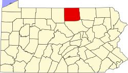
 Map of Tioga County Highlighting Westfield Township | |
 Map of Pennsylvania highlighting Tioga County | |
| Country | United States |
| State | Pennsylvania |
| County | Tioga |
| Settled | 1809 |
| Incorporated | 1821 |
| Area | |
| • Total | 23.09 sq mi (59.80 km2) |
| • Land | 23.09 sq mi (59.80 km2) |
| • Water | 0.00 sq mi (0.00 km2) |
| Population (2010) | |
| • Total | 1,047 |
| • Estimate (2016)[2] | 1,011 |
| • Density | 43.79/sq mi (16.91/km2) |
| Time zone | Eastern Time Zone (North America) |
| • Summer (DST) | EDT |
| FIPS code | 42-117-82976 |
| Historical population | |||
|---|---|---|---|
| Census | Pop. | %± | |
| 2000 | 849 | — | |
| 2010 | 1,047 | 23.3% | |
| 2016 (est.) | 1,011 | [2] | −3.4% |
| U.S. Decennial Census[3] | |||
Westfield Township is a township in Tioga County, Pennsylvania, in the United States. The population was 1,047 at the 2010 census.[4]
Geography[]
According to the United States Census Bureau, the township has a total area of 23.7 square miles (61.4 km2), all of it land.
Westfield Township is bordered by Brookfield Township to the north, Deerfield and Chatham Townships to the east, Clymer Township to the south and Harrison and Hector Townships in Potter County to the west.
Demographics[]
As of the census[5] of 2000, there were 849 people, 338 households, and 267 families residing in the township. The population density was 35.8 people per square mile (13.8/km2). There were 377 housing units at an average density of 15.9/sq mi (6.1/km2). The racial makeup of the township was 99.18% White, 0.24% Native American, 0.12% Asian, 0.12% from other races, and 0.35% from two or more races. Hispanic or Latino of any race were 0.24% of the population.
There were 338 households, out of which 32.8% had children under the age of 18 living with them, 64.5% were married couples living together, 9.8% had a female householder with no husband present, and 21.0% were non-families. 19.2% of all households were made up of individuals, and 9.5% had someone living alone who was 65 years of age or older. The average household size was 2.51 and the average family size was 2.80.
In the township the population was spread out, with 24.3% under the age of 18, 5.3% from 18 to 24, 25.8% from 25 to 44, 26.5% from 45 to 64, and 18.1% who were 65 years of age or older. The median age was 42 years. For every 100 females, there were 95.6 males. For every 100 females age 18 and over, there were 90.2 males.
The median income for a household in the township was $32,500, and the median income for a family was $33,421. Males had a median income of $30,125 versus $21,875 for females. The per capita income for the township was $13,506. About 13.5% of families and 15.7% of the population were below the poverty line, including 19.9% of those under age 18 and 17.2% of those age 65 or over.
Communities and locations[]
- Cowanesque – A village on Pennsylvania Route 49 in the northeast part of the township.
- Phillips – A village at the junction of Pennsylvania Route 49 and Pennsylvania Route 249 in the northeast part of the township.
- Potter Brook – A village on Pennsylvania Route 49 in the western part of the township, near the Potter County line.
- Westfield – A borough in the north-central part of the township, at the junction of Pennsylvania Route 49 and Pennsylvania Route 349.
Government[]
The Westfield Township is governed by three, locally elected Township Supervisors.
- County level
Three, elected at large, County Commissioners.
- State level
- Matt Baker - State Representative, Pennsylvania House of Representatives, District 68
- Joe Scarnati - State Senator, Pennsylvania Senate, District 25
- Federal level
- Glenn Thompson, Republican, Pennsylvania's 5th congressional district
- Pat Toomey, US Senator (elected at large)
- Bob Casey, Jr., US Senator (elected at large)
Education[]

Residents of Westfield Township may attend the local, public schools operated by Northern Tioga School District which provides full day kindergarten through 12th grade. The District provides taxpayer funded preschool. In 2013, the District's enrollment declined to 2,085 students kindergarten through 12th grade. In 2013, Northern Tioga School District ranked 389th out of 498 public schools for academic achievement of its pupils, by the Pittsburgh Business Times.[6]
Westfield Township residents may also apply to attend any of the Commonwealth's 14 public cyber charter schools (in 2013) at no additional cost to the parents. The resident's public school district is required to pay the charter school and cyber charter school tuition for residents who attend these public schools.[7][8] By Commonwealth law, if the District provides transportation for its own students, then the District must provide transportation to any school that lies within 10 miles of its borders. Residents may also seek admission for their school aged child to any other public school district. When accepted for admission, the student's parents are responsible for paying an annual tuition fee set by the Pennsylvania Department of Education. In 2012, the tuition fees for Northern Tioga School District were: Elementary School - $8,463.08, High School - $9,853.49.[9]
BLaST Intermediate Unit #17 provides a wide variety of services to children living in its region which includes Westfield Township. Early screening, special educations services, speech and hearing therapy and many other services like driver education are available. Services for children during the preschool years are provided without cost to their families when the child is determined to meet eligibility requirements.
Community members have access to the Westfield Public Library which is located on Maple Street, in Westfield; the Elkland Area Community Library located on East Parkway Avenue, in Elkland; the Green Free Library in Wellsboro and to the statewide PA Power Library [1] which is an online library funded with tax dollars from the state's education budget.
References[]
- ^ "2016 U.S. Gazetteer Files". United States Census Bureau. Retrieved Aug 14, 2017.
- ^ a b "Population and Housing Unit Estimates". Retrieved June 9, 2017.
- ^ "Census of Population and Housing". Census.gov. Retrieved June 4, 2016.
- ^ "U.S. Census website". United States Census Bureau. Retrieved 2017-02-27.
- ^ "U.S. Census website". United States Census Bureau. Retrieved 2008-01-31.
- ^ Pittsburgh Business Times (April 5, 2013). "Guide to Pennsylvania Schools Statewide ranking 2013".
- ^ Pennsylvania Department of Education (2013). "Charter Schools".
- ^ Pennsylvania Department of Education (2013). "What is a Charter School?".
- ^ Pennsylvania Department of Education (May 2012). "Pennsylvania Public School District Tuition Rates".
Municipalities and communities of Tioga County, Pennsylvania, United States | ||
|---|---|---|
| Boroughs |  | |
| Townships | ||
| CDPs | ||
| Unincorporated communities | ||
| ||
Coordinates: 41°54′00″N 77°31′59″W / 41.90000°N 77.53306°W

- Populated places established in 1809
- Townships in Tioga County, Pennsylvania
- Townships in Pennsylvania