White Oak, Texas
White Oak, Texas | |
|---|---|
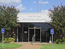 White Oak Municipal Building | |
| Motto(s): "Pride, Tradition" | |
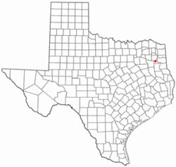 Location of White Oak, Texas | |
 | |
| Coordinates: 32°31′56″N 94°51′27″W / 32.53222°N 94.85750°WCoordinates: 32°31′56″N 94°51′27″W / 32.53222°N 94.85750°W | |
| Country | United States |
| State | Texas |
| County | Gregg |
| Area | |
| • Total | 9.14 sq mi (23.67 km2) |
| • Land | 9.09 sq mi (23.54 km2) |
| • Water | 0.05 sq mi (0.13 km2) |
| Elevation | 413 ft (126 m) |
| Population (2010) | |
| • Total | 6,469 |
| • Estimate (2019)[2] | 6,322 |
| • Density | 695.49/sq mi (268.54/km2) |
| Time zone | UTC-6 (Central (CST)) |
| • Summer (DST) | UTC-5 (CDT) |
| ZIP code | 75693 |
| Area code(s) | 903 |
| FIPS code | 48-78436[3] |
| GNIS feature ID | 1349958[4] |
| Website | City of White Oak, Texas |


White Oak is a city in Gregg County, Texas, United States. The population was 6,340 as of 2020.[5]
History[]
During the early 1800s, the area was inhabited by the Cherokee and Caddo Indians who dominated the East Texas woods. The Cherokees traveled a path through the area, from what is now Nacogdoches Texas to White River Arkansas where they would hunt during the summer months. This trail is known as the Cherokee Trace.
In the later years of the 1800s White Oak was a small farming community with 3 sawmills located on thick forested land. By 1884 there were 15 families living in the area. Most of them had come to work the sawmills or farm the rich soil. A small school was built near Hawkins Creek which doubled as a church. Sadly, the school burned to the ground in 1885 due to suspected arson.
Local land owners, Andrew J Tuttle and his father-in-law, John Bumpus, gathered a group of men in the area to erect a new school. Mr. Tuttle's uncle, Pleas Harris, and Kaleb Bumpus donated ground near a spring on which to build the new school. Andrew Tuttle and John Bumpus noticed the two White Oak trees on either side of the building. It was then decided the community would be known as White Oak.
Geography[]
White Oak is located at 32°31′56″N 94°51′27″W / 32.53222°N 94.85750°W (32.532349, -94.857638).[6]
According to the United States Census Bureau, the city has a total area of 9.1 square miles (24 km2), of which 0.1 square miles (0.26 km2), or 0.55%, is water.
Demographics[]
| Historical population | |||
|---|---|---|---|
| Census | Pop. | %± | |
| 1960 | 1,250 | — | |
| 1970 | 2,300 | 84.0% | |
| 1980 | 4,415 | 92.0% | |
| 1990 | 5,136 | 16.3% | |
| 2000 | 5,624 | 9.5% | |
| 2010 | 6,469 | 15.0% | |
| 2019 (est.) | 6,322 | [2] | −2.3% |
| U.S. Decennial Census[7] | |||
As of the census[3] of 2020, there were 6,340 people, 2,182 households, and 1,595 families residing in the city. The population density was 693.7 people per square mile (267.8/km2). There were 2,182 housing units at an average density of 238.7 per square mile (92.2/km2). The racial makeup of the city was 94.7% White, 1.7% African American, 1.00% Native American, 0.6% Asian, 0.02% Pacific Islander, .7% from other races, and 1.3% from two or more races. Hispanic or Latino of any race were .7% of the population.
There were 2,182 households, out of which 44.6% had children under the age of 18 living with them, 64.7% were married couples living together, 11.0% had a female householder with no husband present, and 20.4% were non-families. 17.5% of all households were made up of individuals, and 7.2% had someone living alone who was 65 years of age or older. The average household size was 2.81 and the average family size was 3.17.
In the city, the population was spread out, with 31.0% under the age of 18, 7.8% from 18 to 24, 30.1% from 25 to 44, 21.6% from 45 to 64, and 9.6% who were 65 years of age or older. The median age was 34 years. For every 100 females, there were 94.1 males. For every 100 females age 18 and over, there were 90.1 males.
The median income for a household in the city was $43,802, and the median income for a family was $50,781. Males had a median income of $44,063 versus $2,530 for females. The per capita income for the city was $17,486. About 9.9% of families and 11.4% of the population were below the poverty line, including 12.4% of those under age 18 and 14.0% of those age 65 or over.
Education[]
The vast majority of the City of White Oak is served by the White Oak Independent School District. A very small portion in the northwestern corner of White Oak is in the Gladewater Independent School District. A small section in the southeast corner of the town is in the Pine Tree Independent School District.
Notable people[]
- Mike Barber, tight end for the Houston Oilers from 1976–81, known for his scandal in the private high school coaching profession and his prison ministry
- Byron Hunt, played for the New York Giants in the early 1980s
- Sam Hunt, linebacker for the New England Patriots from 1974 to 1979
- Max McGee, wide-receiver at Tulane University during the 1950s, later for the Green Bay Packers; scored the first touchdown in Super Bowl I
- , singer / songwriter / multi-instrumentalist for the band Quiet Company
- Kelcy Warren, billionaire chairman and CEO of Energy Transfer Partners, and co-founder of the record label Music Road Records.[8] Donated millions to have the city of Dallas named a city park after his son Klyde Warren.
References[]
- ^ "2019 U.S. Gazetteer Files". United States Census Bureau. Retrieved August 7, 2020.
- ^ a b "Population and Housing Unit Estimates". United States Census Bureau. May 24, 2020. Retrieved May 27, 2020.
- ^ a b "U.S. Census website". United States Census Bureau. Retrieved 2008-01-31.
- ^ "US Board on Geographic Names". United States Geological Survey. 2007-10-25. Retrieved 2008-01-31.
- ^ "Population of Cities of the United States - White Oak Texas". World Population Review. United States Census Bureau. Retrieved November 7, 2011.
{{cite web}}: CS1 maint: url-status (link) - ^ "US Gazetteer files: 2010, 2000, and 1990". United States Census Bureau. 2011-02-12. Retrieved 2011-04-23.
- ^ "Census of Population and Housing". Census.gov. Retrieved June 4, 2015.
- ^ Granberry, Michael (October 20, 2012). "Kelcy Warren emerges as one of Dallas' bold new philanthropists". The Dallas Morning News.
External links[]
Municipalities and communities of Gregg County, Texas, United States | ||
|---|---|---|
| Cities |  | |
| CDPs | ||
| Other communities | ||
| Former communities | ||
| Footnotes | ‡This populated place also has portions in an adjacent county or counties | |
| ||
- Cities in Gregg County, Texas
- Cities in Texas
- Longview metropolitan area, Texas