Whitney Portal, California
Whitney Portal | |
|---|---|
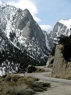 Whitney Portal Road approaches Whitney Portal | |
 Whitney Portal Location in California | |
| Coordinates: 36°35′10″N 118°14′29″W / 36.58611°N 118.24139°WCoordinates: 36°35′10″N 118°14′29″W / 36.58611°N 118.24139°W | |
| Country | United States |
| State | California |
| County | Inyo County |
| Elevation | 8,374 ft (2,552 m) |

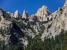
Whitney Portal (formerly, Hunter Flat and Hunters Camp) is the end of the Whitney Portal road in Inyo County, California, 13.7 miles (22 km) west of Lone Pine at an elevation of 8,374 feet (2,552 m).[1] Whitney Portal is the gateway to Mount Whitney, the highest point in the contiguous United States; it is the trailhead for the Mount Whitney Trail. It is also the trailhead for mountaineering routes such the East Face (Mount Whitney), first climbed in 1931, and the Mountaineer's Route, first climbed by John Muir in 1873.[2]
Campgrounds, parking lots, bearproof food storage facilities, a store and a restaurant are located at Whitney Portal.[3] The restaurant is known for serving "obscenely large pancakes, one-inch thick and large enough to be a hubcab on a tractor".[4] as well as a variety of burgers, fries and beers.
History[]
A road reached Whitney Portal in 1936.[5] Previously, the place was called Hunter Flat in honor of William L. Hunter, an Owens Valley pioneer.[5] The road was used in scenes in at least two American feature films, High Sierra (1941), with Humphrey Bogart and Ida Lupino, and The Long, Long Trailer (1954) with Lucille Ball and Desi Arnaz.[6]
In July 2018, the Georges Fire caused the community to be evacuated due to fire threats.[7]
References[]
- ^ Jump up to: a b "8373". NGS data sheet. U.S. National Geodetic Survey. Retrieved 2016-09-25.
- ^ French, Dave. "Whitney Mountaineer's Route". Timberline Trails. Retrieved August 16, 2021.
- ^ Backhurst, Paul (2001). Backpacking California: Over 30 Years of Outdoor Experience. Wilderness Press. p. 185. ISBN 9780899972862.
- ^ Glickman, Joe (2003). To the Top: Reaching for America's 50 State Summits. NorthWord Press. p. 25. ISBN 9781559718714.
- ^ Jump up to: a b Durham, David L. (1998). California's Geographic Names: A Gazetteer of Historic and Modern Names of the State. Clovis, Calif.: Word Dancer Press. p. 1214. ISBN 1-884995-14-4.
- ^ Morfin, Charles Michael (2014). Location Filming in the Alabama Hills. Arcadia Publishing. p. 81. ISBN 9781467131315.
- ^ "Georges Fire Information - InciWeb the Incident Information System". InciWeb. United States National Forest Service. Retrieved 11 July 2018.
| hide Municipalities and communities of Inyo County, California, United States | ||
|---|---|---|
| City |  | |
| CDPs | ||
| Unincorporated communities |
| |
| Indian reservations | ||
| Ghost towns | ||
| Other | ||
| ||
- Unincorporated communities in Inyo County, California
- Owens Valley
- Sierra Nevada
- Unincorporated communities in California
- Tourist attractions in Inyo County, California