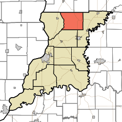
Widner Township, Knox County, Indiana
Widner Township | |
|---|---|
 | |
| Coordinates: 38°51′52″N 87°20′34″W / 38.86444°N 87.34278°WCoordinates: 38°51′52″N 87°20′34″W / 38.86444°N 87.34278°W | |
| Country | United States |
| State | Indiana |
| County | Knox |
| Founded by | John Widner |
| Government | |
| • Type | Indiana township |
| Area | |
| • Total | 41.24 sq mi (106.8 km2) |
| • Land | 41.2 sq mi (107 km2) |
| • Water | 0.04 sq mi (0.1 km2) |
| Elevation | 443 ft (135 m) |
| Population (2010) | |
| • Total | 1,132 |
| • Density | 27.5/sq mi (10.6/km2) |
| Time zone | UTC-5 (EST) |
| • Summer (DST) | UTC-4 (EDT) |
| FIPS code | 18-84158[2] |
| GNIS feature ID | 454058 |

Widner Township is one of ten townships in Knox County, Indiana. As of the 2010 census, its population was 1,132 and it contained 506 housing units.[3]
History[]
Widner Township was named for John Widner, a pioneer settler.[4]
Kixmiller's Store at Freedlandville was added to the National Register of Historic Places in 1978.[5]
Geography[]
According to the 2010 census, the township has a total area of 41.24 square miles (106.8 km2), of which 41.2 square miles (107 km2) (or 99.90%) is land and 0.04 square miles (0.10 km2) (or 0.10%) is water.[3]
References[]
- ^ "US Board on Geographic Names". United States Geological Survey. 2007-10-25. Retrieved 2008-01-31.
- ^ "U.S. Census website". United States Census Bureau. Retrieved 2008-01-31.
- ^ a b "Population, Housing Units, Area, and Density: 2010 - County -- County Subdivision and place -- 2010 Census Summary File 1". United States Census. Archived from the original on 2020-02-12. Retrieved 2013-05-10.
- ^ History of Knox and Daviess County, Indiana: From the Earliest Time to the Present. Goodspeed. 1886. pp. 71.
- ^ "National Register Information System". National Register of Historic Places. National Park Service. July 9, 2010.
Municipalities and communities of Knox County, Indiana, United States | ||
|---|---|---|
| Cities | ||
| Towns | ||
| Townships | ||
| CDPs | ||
| Other unincorporated communities | ||
| ||
This Knox County, Indiana location article is a stub. You can help Wikipedia by . |
Categories:
- Townships in Knox County, Indiana
- Townships in Indiana
- Southwestern Indiana geography stubs