Windorah
This article's lead section may be too short to adequately summarize the key points. (July 2021) |
| Windorah Queensland | |||||||||||||||
|---|---|---|---|---|---|---|---|---|---|---|---|---|---|---|---|
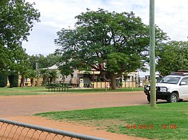 Windorah General Store, 2013 | |||||||||||||||
 Windorah Location in Queensland | |||||||||||||||
| Coordinates | 25°25′14″S 142°39′16″E / 25.4205°S 142.6544°ECoordinates: 25°25′14″S 142°39′16″E / 25.4205°S 142.6544°E | ||||||||||||||
| Population | 115 (2016 census)[1] | ||||||||||||||
| • Density | 0.01302/km2 (0.03371/sq mi) | ||||||||||||||
| Established | 1880 | ||||||||||||||
| Postcode(s) | 4481 | ||||||||||||||
| Elevation | 126.3 m (414 ft) | ||||||||||||||
| Area | 8,835.4 km2 (3,411.4 sq mi) | ||||||||||||||
| Time zone | AEST (UTC+10:00) | ||||||||||||||
| Location | |||||||||||||||
| LGA(s) | Barcoo Shire | ||||||||||||||
| County | Grey | ||||||||||||||
| State electorate(s) | Gregory | ||||||||||||||
| Federal Division(s) | Maranoa | ||||||||||||||
| |||||||||||||||
| |||||||||||||||

Windorah is a town and a locality in the Shire of Barcoo, Queensland, Australia.[2][3] It is one of only three towns in the Shire of Barcoo in Central West Queensland. In the 2016 census, Windorah had a population of 115 people.[1]
Geography[]
Located 35 kilometres (22 mi) downstream from where the Thomson and Barcoo Rivers join to form the multi-channelled Cooper Creek, the Shire covers an area of 60,901 km², the town has a population of 60 people, with a further 40 living at surrounding stations.
A landscape of rocky outcrops, multiple sand hills and black soil flood plains make up most of the area surrounding the town. Water in the town follows the outback cycle of boom and bust. During a wet year Cooper Creek may flood more than a half a dozen times, during the dry it becomes a chain of waterholes. Downstream of the town stretches the Cooper Floodplain below Windorah Important Bird Area, identified as such by BirdLife International because of its importance for waterbirds when flooded.[4]
History[]
Before the onset of white colonisation, the area near and east of Windorah was inhabited by the Kulumali.[citation needed]
The town was founded on a stock route and proclaimed in 1880.[5] Cobb & Co once ran a stage coach service between Windorah and Adavale. It is stated that the town is named after the local Aboriginal word for "Big Fish",[5] although according to an account of the Durack settlers, the name means high, stony place.[6]
Windorah Provisional School opened on 30 July 1888. In 1897 it became a half-time school, sharing a teacher with Cooper's Creek Provisional School, but reverted to a full-time school in 1903. In 1907, it became a half-time school with Cooper's Creek school again, and then closed in 1915. However, it reopened in 1916, only to close again in 1918. In 1926, it reopened and remains operating as Windorah State School.[7] It celebrated its 125th Anniversary in 2013.[8][9]
The town was completely isolated by floodwater in 1949 after surrounding areas were inundated by heavy rainfall. Low cloud and more rain prevented relief food supplies from being delivered by air from a RAAF Dakota.[10]
At the 2006 census, Windorah had a population of 158.[11] In the 2016 census, Windorah's population had decreased to 115, with 20.5% of the population identifying as indigenous.
Climate[]
Windorah is diverse in many aspects. The temperature may range from maximums in summer that approach 50 °C to minimums in winter that are below 0 °C. The annual rainfall has recorded falls between a low of 86 mm and a high of 988 mm. Other weather extremes include 25 morning frosts in 1977, 10 dust storms in 1987 and four hailstorms in 1985.
Economy[]
Sheep and cattle grazing are the mainstay of the district; however, recently oil and gas industries have developed in the area.[citation needed] Many locals also work on the Shire Council and the Dingo Barrier Fence.
Education[]
Windorah State School opened on 30 July 1888 and celebrated its 125th Anniversary in 2013.[8][9]
Attractions[]

Windorah is known as "The Heart of the Channel Country" and offers a welcome and interesting stop-off for travellers to Birdsville, Bedourie, Longreach and points West.
Every year since 1998 Windorah hosts an International Yabby Race on the street outside the hotel. It is held on the Wednesday before the Birdsville Races (first weekend in September). The event raises money for the Royal Flying Doctor Service, community facilities and other charities.[12]
Facilities[]
Windorah has a library, racecourse, local museum, shire hall, information centre and museum.[13]
The Windorah Library is operated by the Barcoo Shire Council and located in Maryborough Street.[14]
See also[]
- Windorah Airport
- Windorah Solar Farm
- Canterbury, a small settlement in the locality of Windorah
References[]
- ^ Jump up to: a b Australian Bureau of Statistics (27 June 2017). "Windorah (SSC)". 2016 Census QuickStats. Retrieved 20 October 2018.

- ^ "Windorah – town in Shire of Barcoo (entry 43917)". Queensland Place Names. Queensland Government. Retrieved 10 June 2019.
- ^ "Windorah – locality in Shire of Barcoo (entry 41480)". Queensland Place Names. Queensland Government. Retrieved 10 June 2019.
- ^ BirdLife International. (2011). Important Bird Areas factsheet: Cooper Floodplain Below Windorah. Downloaded from http://www.birdlife.org Archived 10 July 2007 at WebCite on 2011-12-17.
- ^ Jump up to: a b Environmental Protection Agency (Queensland) (2002). Heritage Trails of the Queensland Outback. State of Queensland. p. 127. ISBN 0-7345-1040-3.
- ^ Durack, Mary (1959). Kings in Grass Castles.
- ^ Queensland Family History Society (2010), Queensland schools past and present (Version 1.01 ed.), Queensland Family History Society, ISBN 978-1-921171-26-0
- ^ Jump up to: a b "Opening and closing dates of Queensland Schools". Queensland Government. Retrieved 18 April 2019.
- ^ Jump up to: a b "Windorah State School". Education Queensland. Archived from the original on 10 March 2016. Retrieved 30 January 2016.
- ^ "Family rescued from flood". Townsville Daily Bulletin. Queensland: National Library of Australia. 25 March 1949. p. 1. Archived from the original on 5 September 2020. Retrieved 24 March 2013.
- ^ Australian Bureau of Statistics (25 October 2007). "Windorah (Barcoo Shire) (State Suburb)". 2006 Census QuickStats. Retrieved 25 June 2011.
- ^ "Windorah International Yabby Races". Tourism & Events Queensland. Archived from the original on 15 April 2019. Retrieved 28 April 2019.
- ^ "Barcoo". Centre for the Government of Queensland. Archived from the original on 14 April 2011. Retrieved 21 December 2011.
- ^ "Public Library Directory". Public Libraries Connect. 5 September 2017. Archived from the original on 19 January 2018. Retrieved 19 January 2018.
External links[]
![]() Media related to Windorah at Wikimedia Commons
Media related to Windorah at Wikimedia Commons
- Towns in Queensland
- Populated places established in 1880
- Central West Queensland
- 1880 establishments in Australia
- Shire of Barcoo
- Localities in Queensland