Winterville, Mississippi
Winterville, Mississippi | |
|---|---|
 Winterville, Mississippi | |
 Winterville | |
| Coordinates: 33°30′06″N 91°03′30″W / 33.50167°N 91.05833°WCoordinates: 33°30′06″N 91°03′30″W / 33.50167°N 91.05833°W | |
| Country | United States |
| State | Mississippi |
| County | Washington |
| Elevation | 122 ft (37 m) |
| Time zone | UTC-6 (Central (CST)) |
| • Summer (DST) | UTC-5 (CDT) |
| ZIP code | 38782 |
| Area code(s) | 662 |
| GNIS feature ID | 679793[1] |


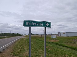
Winterville is a census-designated place and unincorporated community located in Washington County, Mississippi, near Mississippi Highway 1. Winterville is approximately 3 miles (4.8 km) north of Greenville, the county seat, and approximately 4 miles (6.4 km) south of Lamont.
The Winterville Site, a National Historic Landmark featuring more than twelve major earthwork mounds from the period of 11th to 15th centuries, is located near Winterville along Mississippi 1. It is the type site of the Plaquemine Mississippian culture, from which the Natchez Indians descended. Preceding cultures also constructed mounds in this area.
Education[]
It is in the Western Line School District.[2]
References[]
- ^ U.S. Geological Survey Geographic Names Information System: Winterville, Mississippi
- ^ "2020 CENSUS - SCHOOL DISTRICT REFERENCE MAP: Washington County, MS" (PDF). U.S. Census Bureau. Retrieved 2021-06-09.
| show Municipalities and communities of Washington County, Mississippi, United States |
|---|

| show Authority control |
|---|
This Washington County, Mississippi state location article is a stub. You can help Wikipedia by . |
- Unincorporated communities in Washington County, Mississippi
- Unincorporated communities in Mississippi
- Census-designated places in Washington County, Mississippi
- Mississippi Delta region geography stubs