River in the United States of America
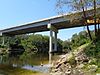
Withlacoochee River near the confluence with the
Suwannee River The Withlacoochee River originates in Georgia , northwest of Nashville, Georgia . It flows south through Berrien County where it joins the New River and forms part of the boundary between Berrien and Cook counties. It then flows south into Lowndes County, Georgia . At Troupville, Georgia the Little River joins the Withlacoochee River flows continues to flow south and forms part of the boundary between Lowndes and Brooks counties in Georgia . The river then flows into Florida for 1.34 miles Florida before returning into Georgia for an additional 2.44 miles. It then returns to Florida, forming the northeast boundary of Madison County, Florida and the western boundary of Hamilton County, Florida and eventually merges with the Suwannee at Suwannee River State Park west of Live Oak . The river is 115 miles (185 km) long.[1] river of the same name .
Etymology [ ] The Withlacoochee River received its name from the Muskogean peoples who inhabited South Georgia. It comes from the compound Creek word ue-rakkuce [IPA: wiɬakːut͡ʃi ], from ue "water", rakko "big", and -uce "small", with the rough translation "little river."[2] [3] voiceless lateral spelled r to "thl".
Crossings [ ]
Crossing
River Miles
Carries
Image
Location
ID number
Coordinates
Georgia [ ]
SP4 Derrell Danforth Bridge
~115
SR 354
Lenox, Georgia to Alapaha, Georgia
31°19′21″N 83°17′51″W / 31.322594°N 83.297435°W / 31.322594; -83.297435
Oak Ford Bridge
~106
SR 125
Tifton, Georgia to Nashville, Georgia
31°12′54″N 83°16′09″W / 31.215092°N 83.269252°W / 31.215092; -83.269252
Georgia and Florida Railroad (Abandoned 1967)
31°12′20″N 83°16′22″W / 31.205501°N 83.272724°W / 31.205501; -83.272724
POW Fred L. Belcher Bridge
~105
SR 76
Adel, Georgia to Nashville, Georgia
31°11′50″N 83°16′18″W / 31.197289°N 83.271790°W / 31.197289; -83.271790
Shellie W. Parrish Memorial Bridge
97.65[4]
SR 37
Adel, Georgia to Ray City, Georgia
31°07′13″N 83°19′17″W / 31.120233°N 83.321272°W / 31.120233; -83.321272
B Williams Bridge
Old Lois Road (Closed)
31°07′58″N 83°18′45″W / 31.132777°N 83.312516°W / 31.132777; -83.312516
Futchs Bridge/Ferry
95.2
Coffee Road
31°05′46″N 83°19′00″W / 31.096088°N 83.316711°W / 31.096088; -83.316711
Hagan Bridge
84.7
SR 122
Hahira, Georgia to Lakeland, Georgia
31°00′50″N 83°18′06″W / 31.013867°N 83.301798°W / 31.013867; -83.301798
Tyler Bridge
79.8
Franklinville Road (Closed)
30°58′53″N 83°16′04″W / 30.981372°N 83.267727°W / 30.981372; -83.267727
Skipper Bridge
Reed Road (Defunct)
30°57′25″N 83°16′11″W / 30.957000°N 83.269800°W / 30.957000; -83.269800
New Skipper Bridge
76.3
Skipper Bridge Road
30°56′57″N 83°16′19″W / 30.949038°N 83.271902°W / 30.949038; -83.271902
Staten Road Bridge
74.3
Staten Road
30°55′59″N 83°17′20″W / 30.932936°N 83.289006°W / 30.932936; -83.289006
Fender Bridge
Staten Road (Defunct since before 1990s)
30°55′59″N 83°17′21″W / 30.933004°N 83.289189°W / 30.933004; -83.289189
Double Bridges
69.1
US 41 SR 7
Valdosta, Georgia
30°53′34″N 83°19′08″W / 30.892708°N 83.318815°W / 30.892708; -83.318815
Norfolk Southern Railway Georgia Southern and Florida Railway
Valdosta, Georgia
30°51′48″N 83°19′18″W / 30.863285°N 83.321587°W / 30.863285; -83.321587
63.5
Interstate 75
Troupville, Georgia
30°51′18″N 83°20′04″W / 30.855028°N 83.334319°W / 30.855028; -83.334319
62.6
SR 133
Troupville, Georgia
30°51′00″N 83°20′22″W / 30.849994°N 83.339580°W / 30.849994; -83.339580
Valdosta, Moultrie and Western Railroad (Closed 1923, now defunct)
30°50′28″N 83°21′12″W / 30.841114°N 83.353470°W / 30.841114; -83.353470
51.8
US 84 /221 Ousley, Georgia to Quitman, Georgia
30°47′37″N 83°27′13″W / 30.793568°N 83.453476°W / 30.793568; -83.453476
Spook Bridge
51.7
Old Quitman Highway (Closed)
Blue Springs, Georgia
30°47′23″N 83°27′06″W / 30.789828°N 83.451651°W / 30.789828; -83.451651
51.7
CSX Transportation Atlantic and Gulf Railroad
30°47′34″N 83°27′12″W / 30.792882°N 83.453391°W / 30.792882; -83.453391
Spains Bridge/Ferry
Historically Spains Ferry Road (Defunct)
Spains Ferry
30°44′57″N 83°28′57″W / 30.749137°N 83.482455°W / 30.749137; -83.482455
Knights Bridge/Ferry
Historically Knights Ferry Road (Defunct)
Knights Ferry
30°42′40″N 83°27′17″W / 30.711146°N 83.454755°W / 30.711146; -83.454755
Rocky Ford Bridge
36.7
Rocky Ford Road/Clyattville-Nankin Road
Rocky Ford
30°40′30″N 83°23′40″W / 30.674944°N 83.394416°W / 30.674944; -83.394416
Georgia – Florida [ ]
31.1
Valdosta Railway (Closed 1973)
30°38′12″N 83°21′02″W / 30.636634°N 83.350468°W / 30.636634; -83.350468
Georgia [ ]
Horns Ferry Bridge
27.8
SR 31
SR 145
Clyattville, Georgia to Pinetta, Florida
30°38′07″N 83°18′42″W / 30.635379°N 83.311598°W / 30.635379; -83.311598
Old Horns Ferry Bridge
27.7
(Built 1895, closed 1940, defunct)
Clyattville, Georgia to Pinetta, Florida
30°38′07″N 83°18′35″W / 30.635298°N 83.309595°W / 30.635298; -83.309595
Florida [ ]
22.4
SR 150
Bellville, Florida
30°35′48″N 83°15′35″W / 30.596707°N 83.259861°W / 30.596707; -83.259861
22.3
(Defunct)
Bellville, Florida
30°35′45″N 83°15′34″W / 30.595830°N 83.259471°W / 30.595830; -83.259471
(Defunct)
Madison Blue Spring State Park
30°28′58″N 83°14′37″W / 30.482897°N 83.243676°W / 30.482897; -83.243676
12.0
SR 6
Madison Blue Spring State Park
320016
30°28′56″N 83°14′36″W / 30.482288°N 83.243448°W / 30.482288; -83.243448
West Bridge
2.3
SR 141
30°24′37″N 83°10′48″W / 30.410215°N 83.179994°W / 30.410215; -83.179994
Notes [ ] External links [ ]
Significant waterways of Florida
Larger rivers Lakes Smaller rivers Creeks and Canals See also
Coastal waters of Florida Everglades Intracoastal Waterway Indian River Lagoon List of Florida rivers List of major springs in Florida Okeechobee Waterway Okefenokee Swamp Outstanding Florida Waters Paynes Prairie
Significant waterways of Georgia
Larger rivers Lakes Smaller rivers Tidal rivers Creeks and Canals See also
Coordinates : 30°23′14.2″N 83°10′17.9″W / 30.387278°N 83.171639°W / 30.387278; -83.171639