Witosławice, Opole Voivodeship
Witosławice | |
|---|---|
Village | |
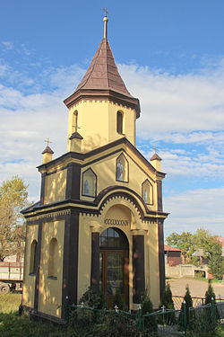 Chapel | |
 Witosławice | |
| Coordinates: 50°12′N 18°7′E / 50.200°N 18.117°E | |
| Country | |
| Voivodeship | Opole |
| County | Kędzierzyn-Koźle |
| Gmina | Polska Cerekiew |
| Population | 209 |

Witosławice [vitɔswaˈvit͡sɛ] (German: Witoslawitz, 1936-45: Wiesenstein) is a village in the administrative district of Gmina Polska Cerekiew, within Kędzierzyn-Koźle County, Opole Voivodeship, in south-western Poland.[1] It lies approximately 4 kilometres (2 mi) south of Polska Cerekiew, 18 km (11 mi) south of Kędzierzyn-Koźle, and 54 km (34 mi) south of the regional capital Opole.
Before 1945 the area was part of Germany (see Territorial changes of Poland after World War II).
The village has a population of 209.
References[]
Coordinates: 50°12′N 18°7′E / 50.200°N 18.117°E
This Kędzierzyn-Koźle County location article is a stub. You can help Wikipedia by . |
Categories:
- Villages in Kędzierzyn-Koźle County
- Kędzierzyn-Koźle County geography stubs