Wolfersdorf, Haut-Rhin
Wolfersdorf | |
|---|---|
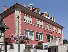 The town hall and school in Wolfersdorf | |
 Coat of arms | |
show Location of Wolfersdorf | |
 Wolfersdorf | |
| Coordinates: 47°38′29″N 7°06′51″E / 47.6414°N 7.1142°ECoordinates: 47°38′29″N 7°06′51″E / 47.6414°N 7.1142°E | |
| Country | France |
| Region | Grand Est |
| Department | Haut-Rhin |
| Arrondissement | Altkirch |
| Canton | Masevaux |
| Intercommunality | |
| Government | |
| • Mayor (2020–2026) | Claude Jud[1] |
| Area 1 | 3.66 km2 (1.41 sq mi) |
| Population (Jan. 2018)[2] | 375 |
| • Density | 100/km2 (270/sq mi) |
| Time zone | UTC+01:00 (CET) |
| • Summer (DST) | UTC+02:00 (CEST) |
| INSEE/Postal code | 68378 /68210 |
| Elevation | 287–348 m (942–1,142 ft) (avg. 297 m or 974 ft) |
| 1 French Land Register data, which excludes lakes, ponds, glaciers > 1 km2 (0.386 sq mi or 247 acres) and river estuaries. | |


Wolfersdorf is a commune in the Haut-Rhin department in Alsace in north-eastern France.
Population[]
| Year | Pop. | ±% |
|---|---|---|
| 2006 | 380 | — |
| 2007 | 383 | +0.8% |
| 2008 | 393 | +2.6% |
| 2009 | 384 | −2.3% |
| 2010 | 374 | −2.6% |
| 2011 | 363 | −2.9% |
| 2012 | 351 | −3.3% |
| 2013 | 346 | −1.4% |
| 2014 | 353 | +2.0% |
| 2015 | 360 | +2.0% |
| 2016 | 367 | +1.9% |
See also[]
References[]
- ^ "Répertoire national des élus: les maires". data.gouv.fr, Plateforme ouverte des données publiques françaises (in French). 2 December 2020.
- ^ "Populations légales 2018". INSEE. 28 December 2020.
| Wikimedia Commons has media related to Wolfersdorf (Haut-Rhin). |
| show Authority control |
|---|
This Haut-Rhin geographical article is a stub. You can help Wikipedia by . |
Categories:
- Communes of Haut-Rhin
- Haut-Rhin geography stubs