
Worgret
| Worgret | |
|---|---|
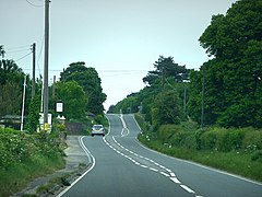 A352 road at Worgret | |
 Worgret Location within Dorset | |
| OS grid reference | SY907870 |
| Civil parish | |
| District |
|
| Shire county | |
| Region | |
| Country | England |
| Sovereign state | United Kingdom |
| Post town | WAREHAM |
| Postcode district | BH20 |
| Dialling code | 01929 |
| Police | Dorset |
| Fire | Dorset and Wiltshire |
| Ambulance | South Western |
| UK Parliament | |
Worgret /ˈwɔːrɡrɪt/ is a hamlet in the English county of Dorset. It is situated immediately to the west of the town of Wareham.
Worgret forms part of the civil parish of Arne, within the Purbeck local government district.
Name[]
Worgret shares its name with a 7th-century Abbot of Glastonbury reported by William of Malmesbury.[1]
References[]
- ^ Edward Huttom, London, 1919, Highways and Byways of Somerset, p.156.
External links[]
![]() Media related to Worgret at Wikimedia Commons
Media related to Worgret at Wikimedia Commons
Towns, villages and hamlets in the Purbeck district of Dorset, England | ||
|---|---|---|
 |
| |
This Dorset location article is a stub. You can help Wikipedia by . |
Categories:
- Hamlets in Dorset
- Dorset geography stubs