Woudrichem
Woudrichem | |
|---|---|
City and former municipality | |
 Martin Church and houses in 2015 | |
 Flag Coat of arms | |
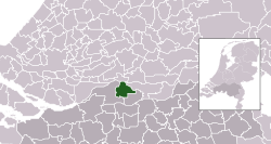 Location in North Brabant | |
| Coordinates: 51°49′N 5°0′E / 51.817°N 5.000°ECoordinates: 51°49′N 5°0′E / 51.817°N 5.000°E | |
| Country | Netherlands |
| Province | North Brabant |
| Municipality | Altena |
| Merged | 2019 |
| Area | |
| • Total | 51.70 km2 (19.96 sq mi) |
| • Land | 49.34 km2 (19.05 sq mi) |
| • Water | 2.36 km2 (0.91 sq mi) |
| Elevation | 0 m (0 ft) |
| Demonym(s) | Woudrichemmer |
| Time zone | UTC+1 (CET) |
| • Summer (DST) | UTC+2 (CEST) |
| Postcode | 4280–4288 |
| Area code | 0183 |
| Website | www |

Woudrichem (Dutch pronunciation: [ˈʋʌudriɣəm] (![]() listen); Brabantian: Woerkum) is a city and former municipality in the province of North Brabant in the Netherlands.
listen); Brabantian: Woerkum) is a city and former municipality in the province of North Brabant in the Netherlands.
History[]

The city of Woudrichem was granted city rights in 1356.
Geography[]

The municipality is located at 51°49′N 5°0′E / 51.817°N 5.000°E in the north of North Brabant just south of the center of the Netherlands. It is part of the region of Land van Heusden en Altena.
The city of Woudrichem is the largest settlement in the municipality. It is situated on the southbank of where the rivers Waal and Afgedamde Maas join to form the Boven Merwede. The other population centres in the municipality were:
East of the city lies Loevestein Castle, on the other side of the river in the province of Gelderland.
Gallery[]

Historical port in Woudrichem

Historical port in Woudrichem

Street view in Woudrichem

Reformed church in Giessen
Annual Fish Baking Championship on Ascension Day


Government[]
The municipal council of Woudrichem had 15 members. The mayor was of the Reformed Political Party. On January 1sth 2019 it joined Werkendam and Aalburg in the new municipality of Altena.
Notable people[]
- Louwrens Hanedoes (1822 in Woudrichem - 1905 in Woudrichem) landscape painter; in the Romantic style, later turning to Realism.
References[]
- ^ "Kerncijfers wijken en buurten 2020" [Key figures for neighbourhoods 2020]. StatLine (in Dutch). CBS. 24 July 2020. Retrieved 19 September 2020.
- ^ "Postcodetool for 4285CP". Actueel Hoogtebestand Nederland (in Dutch). Het Waterschapshuis. Retrieved 9 June 2014.
- ^ "Bevolkingsontwikkeling; regio per maand" [Population growth; regions per month]. CBS Statline (in Dutch). CBS. 1 January 2019. Retrieved 1 January 2019.
External links[]
 Media related to Woudrichem at Wikimedia Commons
- Official website
| hide Places adjacent to Woudrichem | ||||||||||
|---|---|---|---|---|---|---|---|---|---|---|
| ||||||||||
| Authority control |
|
|---|
This North Brabant location article is a stub. You can help Wikipedia by . |
- Geography of Altena, North Brabant
- Land van Heusden en Altena
- Former municipalities of North Brabant
- Populated places in North Brabant
- Populated places disestablished in 2019
- Cities in the Netherlands
- North Brabant geography stubs