Wunjunga, Queensland
| Wunjunga Queensland | |||||||||||||||
|---|---|---|---|---|---|---|---|---|---|---|---|---|---|---|---|
 Wunjunga viewed from Mount Inkerman, Nov 2005 | |||||||||||||||
 Wunjunga | |||||||||||||||
| Coordinates | 19°46′28″S 147°34′38″E / 19.7745°S 147.5772°ECoordinates: 19°46′28″S 147°34′38″E / 19.7745°S 147.5772°E | ||||||||||||||
| Population | 9 (2016 census)[1] | ||||||||||||||
| • Density | 0.127/km2 (0.328/sq mi) | ||||||||||||||
| Postcode(s) | 4806 | ||||||||||||||
| Area | 71.1 km2 (27.5 sq mi) | ||||||||||||||
| Location | |||||||||||||||
| LGA(s) | Shire of Burdekin | ||||||||||||||
| State electorate(s) | Burdekin | ||||||||||||||
| Federal division(s) | Dawson | ||||||||||||||
| |||||||||||||||

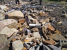
Rubble still litters the beach some 17 years after Cyclone Aivu hit
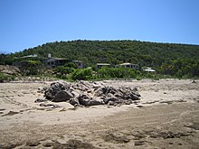
Township of Wunjunga viewed from the Beach in Upstart Bay, 19 Feb 2006

Rocky Outcrops on Beach at Wunjunga, 19 Feb 2006
Wunjunga is a coastal locality in the Shire of Burdekin in Queensland, Australia.[2] In the 2016 census, Wunjunga had a population of 9 people.[1]
Geography[]
It is located south of Home Hill in North Queensland. The waters of the Coral Sea form the eastern boundary.[3]
Road infrastructure[]
The Bruce Highway runs along the western boundary.
References[]
- ^ a b Australian Bureau of Statistics (27 June 2017). "Wunjunga (SSC)". 2016 Census QuickStats. Retrieved 20 October 2018.

- ^ "Wunjunga (entry 42305)". Queensland Place Names. Queensland Government. Retrieved 14 January 2016.
- ^ Google (14 August 2021). "Wunjunga, Queensland" (Map). Google Maps. Google. Retrieved 14 August 2021.
This Queensland location article is a stub. You can help Wikipedia by . |
Categories:
- Shire of Burdekin
- Localities in Queensland
- Queensland geography stubs