Yazd Province
Yazd Province
استان یزد | |
|---|---|
 Clockwise from top left: Meybod as seen from Narin Qal'eh, Tower of Silence outside Yazd, Amir Chakhmaq Mosque and Kharanaq in Ardakan County. | |
 Yazd counties | |
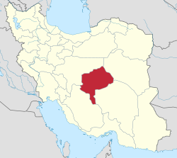 Location of Yazd Province in Iran | |
| Coordinates: 31°53′41″N 54°21′25″E / 31.8948°N 54.3570°ECoordinates: 31°53′41″N 54°21′25″E / 31.8948°N 54.3570°E | |
| Country | |
| Region | Region 5 |
| Capital | Yazd |
| Counties | 10 |
| Government | |
| • Governor-general | Mohammad-Ali Talebi |
| Area | |
| • Total | 76,469 km2 (29,525 sq mi) |
| Population (2016)[1] | |
| • Total | 1,138,533 |
| • Density | 15/km2 (39/sq mi) |
| Time zone | UTC+03:30 (IRST) |
| • Summer (DST) | UTC+04:30 (IRST) |
| Main language(s) | Persian |
| HDI (2017) | 0.824[2] very high · 5th |
| Website | ostanyazd.ir |

| Year | Pop. | ±% |
|---|---|---|
| 2006 | 924,386 | — |
| 2011 | 1,003,680 | +8.6% |
| 2016 | 1,138,533 | +13.4% |
| amar.org.ir Excludes areas that were part of the province during the previous censuses | ||
Yazd Province (Persian: استان یزد, Ostān-e Yazd) is one of the 31 provinces of Iran. It is in the centre of the country, and its administrative center is the city of Yazd. In 2014, it was placed in Region 5.[3]

The province has an area of 76,469 km², and according to the most recent divisions of the country, is divided into ten counties: Abarkuh County, Ardakan County, Bafq County, Behabad County, Khatam County, Mehriz County, Meybod County, Ashkezar County, Taft County, and Yazd County. According to the 1996 census, Yazd province had a population of about 750,769, of which 75.1% were urban residents while 24.9% resided in rural areas. At the 2011 census, its population (including Tabas County, which was transferred to South Khorasan Province) was 1,074,428, in 258,691 families; excluding Tabas County, its population (as of 2006) was 895,276, in 241,846 families.[4]
The city of Yazd is the economic and administrative capital of the province and therefore the most heavily populated.


Geography[]
Yazd province with the area of 129,285 km2 (49,917 sq mi)[5] is situated at an oasis where the Dasht-e Kavir desert and the Dasht-e Lut desert meet. The city itself is sometimes called "the bride of the Kavir" because of its location, in a valley between Shir Kuh, the tallest mountain in the region at 4,075 m (13,369 ft) above sea level, and Kharaneq. The city proper is located at 1,203 m (3,947 ft) above sea-level, and covers 16,000 km2 (6,200 sq mi).
According to the administrative division rules, the Yazd province is divided into 9 counties, each including at least one town and a number of districts, rural districts (dehestans), and villages.
| County | Area | Population | Cities | Dehestans | ||||||||
|---|---|---|---|---|---|---|---|---|---|---|---|---|
| Abarkuh | 5,941 | 75,205 | 2 | 4 | ||||||||
| Ardakan | 6,717 | 70,000 | 2 | 5 | ||||||||
| Meybod | 6,941 | 72,000 | 3 | 6 | ||||||||
| Bafq | 15,298 | 41,000 | 2 | 6 | ||||||||
| Khatam | 7,931 | 32,000 | 2 | 4 | ||||||||
| Mehriz | 6,717 | 74,000 | 1 | 5 | ||||||||
| Ashkezar | 5,486 | 26,300 | 2 | 3 | ||||||||
| Taft | 5,948 | 56,000 | 2 | 10 | ||||||||
| Yazd | 2,397 | 526,276 | 4 | 4 | ||||||||
| Behabad | 8,235 | 27,800 | 1 | 3 | ||||||||
| Source:Geography Book of Yazd | ||||||||||||
Mountains of Yazd[]
- South- and Southwestern Mountains
This group is wider than the other ridges and includes Shir Kuh
- Eastern Mountains
They are located in east of Yazd province with the highest peaks being (3002)
References[]
- ^ "National census 2016". amar.org.ir. Retrieved 2017-03-14.[]
- ^ "Sub-national HDI - Area Database - Global Data Lab". hdi.globaldatalab.org. Retrieved 2018-09-13.
- ^ "همشهری آنلاین-استانهای کشور به ۵ منطقه تقسیم شدند (Provinces were divided into 5 regions)". Hamshahri Online (in Persian). 22 June 2014 [1 Tir 1393, Jalaali]. Archived from the original on 23 June 2014.
- ^ "Archived copy" (PDF). Archived from the original (PDF) on 2015-11-16. Retrieved 2015-11-16.CS1 maint: archived copy as title (link)
- ^ Statoids.com

| Authority control |
|---|
- Yazd Province
- Provinces of Iran