Yoder, Kansas
Yoder, Kansas | |
|---|---|
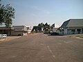
 Hardware & Lumber (2014) | |
 | |
 Yoder | |
| Coordinates: 37°56′25″N 97°52′6″W / 37.94028°N 97.86833°WCoordinates: 37°56′25″N 97°52′6″W / 37.94028°N 97.86833°W[1] | |
| Country | United States |
| State | Kansas |
| County | Reno |
| Township | |
| Founded | 1889 |
| Area | |
| • Total | 37.6 sq mi (97.5 km2) |
| • Land | 37.2 sq mi (96.5 km2) |
| • Water | 0.4 sq mi (1.0 km2) |
| Elevation | 1,539 ft (469 m) |
| Population | |
| • Total | 194 |
| • Density | 5.2/sq mi (2.0/km2) |
| Time zone | UTC-6 (CST) |
| • Summer (DST) | UTC-5 (CDT) |
| ZIP code | 67585 |
| Area code | 620 Exchange: 465 |
| FIPS code | 20-80750 [1] |
| GNIS ID | 473653 [1] |
| Website | yoderkansas.com |


Yoder is an unincorporated community in Reno County, Kansas, United States.[1] It is located approximately 10 miles southeast of the city of Hutchinson on K-96. As of the 2010 census, its population was 194.[2] Although Yoder is unincorporated, with no city government, it does have a U.S. Post Office and its own ZIP code (67585). Yoder is the hub of a local Amish community and derives its name from its Amish founder, Valentine Yoder.
History[]
The first post office in Yoder was established in November 1889.[3]
The community was home to the former Naval Air Station Hutchinson, later renamed to Hutchinson Air Force Station, and currently named as Sunflower Aerodrome Gliderport.
Geography[]
Climate[]
The climate in this area is characterized by hot, humid summers and generally mild to cool winters. According to the Köppen Climate Classification system, Yoder has a humid subtropical climate, abbreviated "Cfa" on climate maps.[4]
Demographics[]
For statistical purposes, the United States Census Bureau has defined Yoder as a census-designated place (CDP).
Education[]
The community is served by Haven USD 312 public school district.
Area events[]
Yoder Heritage Day takes place annually on the fourth Saturday in August.[5]
Gallery[]
Looking south down Main Street (2006)

Demelia's Quilt Co (2014)

Discount Grocery (2014)

Horse-drawn carriage (2003)


References[]
- ^ a b c d e Geographic Names Information System (GNIS) details for Yoder, Kansas; United States Geological Survey (USGS); October 13, 1978.
- ^ a b "2010 City Population and Housing Occupancy Status". U.S. Census Bureau. Retrieved March 27, 2011.[dead link]
- ^ "Kansas Post Offices, 1828-1961". Kansas Historical Society. p. 2. Retrieved June 22, 2014.
- ^ Climate Summary for Yoder, Kansas
- ^ Yoder Heritage Day
Further reading[]
External links[]
| Wikimedia Commons has media related to Yoder, Kansas. |
- Community of Yoder
- Yoder Heritage Day.
- "Yoder Amish Settlement". Amish State Guide.
- Reno County Maps: Current, Historic, KDOT
Municipalities and communities of Reno County, Kansas, United States | ||
|---|---|---|
| Cities |  | |
| Unincorporated communities | ||
| Ghost towns | ||
| Townships |
| |
| Footnotes | †This populated place is designated a Census-Designated Place (CDP) by the United States Census Bureau. | |
| ||
- Census-designated places in Reno County, Kansas
- Amish in the United States
- Populated places established in 1889
- Census-designated places in Kansas
- 1889 establishments in Kansas