Young Glacier
| Young Glacier | |
|---|---|
 Location of Sentinel Range in Western Antarctica. | |
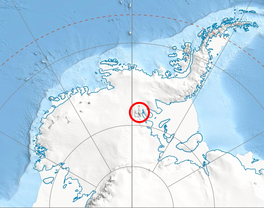
 Location of Young Glacier in Antarctica | |
| Location | Maglenik Heights Sentinel Range Ellsworth Land |
| Coordinates |  78°4′20″S 84°49′00″W / 78.07222°S 84.81667°W / -78.07222; -84.81667 78°4′20″S 84°49′00″W / 78.07222°S 84.81667°W / -78.07222; -84.81667 |
| Length | 8 nmi (15 km; 9 mi) |
| Thickness | unknown |
| Status | unknown |

Young Glacier ( WikiMiniAtlas78°4′S 84°49′W / 78.067°S 84.817°W / -78.067; -84.817) is a glacier which flows from Mount Gozur and Ichera Peak in Maglenik Heights eastwards for 8 miles (13 km) and terminates at the north end of Barnes Ridge on the east side of Sentinel Range, Ellsworth Mountains in Antarctica. It was first mapped by the United States Geological Survey (USGS) from surveys and U.S. Navy air photos from 1957–59. It was named by the Advisory Committee on Antarctic Names (US-ACAN) for First Lieutenant of the United States Air Force (USAF), who participated in establishing the South Pole Station in the 1956–57 season.
See also[]
- List of glaciers in the Antarctic
- Glaciology
Maps[]
- Vinson Massif. Scale 1:250 000 topographic map. Reston, Virginia: US Geological Survey, 1988.
- Antarctic Digital Database (ADD). Scale 1:250000 topographic map of Antarctica. Scientific Committee on Antarctic Research (SCAR). Since 1993, regularly updated.
 This article incorporates public domain material from the United States Geological Survey document: "Young Glacier". (content from the Geographic Names Information System)
Glaciers in the Antarctic | |
|---|---|
|
Glaciers of Ellsworth Land | |
|---|---|
|
This article about a glacier in Ellsworth Land is a stub. You can help Wikipedia by . |
- v
- t
- Ellsworth Mountains
- Glaciers of Ellsworth Land
- Ellsworth Land glacier stubs
- Coordinates on Wikidata
- Wikipedia articles incorporating text from the USGS Geographic Names Information System
- All stub articles