Ystalyfera
This article needs additional citations for verification. (October 2011) |
| Ystalyfera | |
|---|---|
 Ystalyfera from Varteg Hill | |
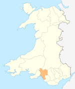
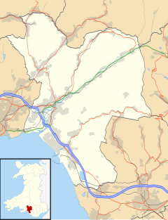 Ystalyfera Location within Neath Port Talbot | |
| Population | 3,019 (2011 census) [1] |
| OS grid reference | SN767089 |
| Principal area | |
| Ceremonial county | |
| Country | Wales |
| Sovereign state | United Kingdom |
| Post town | SWANSEA |
| Postcode district | SA9 |
| Dialling code | 01639 |
| Police | South Wales |
| Fire | Mid and West Wales |
| Ambulance | Welsh |
| UK Parliament | |
| Senedd Cymru – Welsh Parliament |
|
| Councillors |
|


Ystalyfera is a former industrial village and community in the upper Swansea Valley, on the River Tawe, about 13 miles (21 km) northeast of Swansea. It is an electoral ward and a community in the unitary authority of Neath Port Talbot, Wales, comprising a resident population of just over 3,000 people, approximately 60% of whom speak Welsh.[2]
National Cycle Route 43 passes through the village.
History[]
The history of Ystalyfera begins with a small farming family who shared the land. This is reflected in the village's name, composed from the Welsh words, ynys (meaning island), tal (meaning tall) and berran (a composite of ber and rhan, indicating a land-share - a short piece of shared land, probably between agricultural labourers).[citation needed] The history of the name can be seen as it evolved through the ages: -
- 1582 Ynys Tal y Feran
- 1604 Tir Ynystalferran
- 1797 Stalyfera Issa, Ycha, Genol
- 1831 Ystalyfera
Ystalyfera grew as a village with the advent of coal mining and iron working, which were a huge part of everyday life in the local communities of the Swansea Valley (Welsh: Cwmtawe).
In 1838 a furnace was built by James Palmer Budd at Ystalyfera and from this grew the iron and tinplate works which by 1863 was described as 'the largest tinplate manufactory in the world'. A new cold-blast process was successfully introduced here and, despite some early crises, the works prospered. By the mid-1850s there were forty furnaces for puddling and balling in operation and sixteen tin mills and houses. The output of iron increased from the 4,893 tons of 1843 to 29,828 tons in 1858. The works continued to grow during the 1860s and reached peak production in 1872 with the sale of 182,000 boxes of tinplate.
By this time, however, the years of prosperity were numbered. The 1870s witnessed little further addition to the plant of the works. Steel had now come to challenge iron on a larger scale, new methods of production demanded the energy, technical skill and capital which the ageing J. P. Budd at Ystalyfera could not supply. The works continued to operate during the eighteen seventies, but with Budd's death in 1880 the end was in sight. By this time the works were incurring heavy losses and late in 1885 the works finally closed. For more than forty years the works had been the colossus of the district and, more than anything else, had been responsible for the transformation of the latter's economic basis and social structure. Less significant in their contribution were the two ironworks, at Pontardawe and Brynamman, though both became substantial producers of tinplate from the 1860s.
The expansion in iron production inevitably created a heavy demand for local coal. The middle decades of the 19th century saw the expansion of existing mines and the sinking of new ones in the parish and the neighbouring districts.
With the closure of the iron works and later the coalmines, Ystalyfera suffered very heavily on the economic front. Through the 20th century, the village rebuilt and redefined its role. At present, there are small businesses that run in the village, although many of the village's inhabitants commute to nearby Swansea or Neath to work.
Gurnos Chapel[]
The original chapel, located opposite the Old Swan and New Swan Inns, was built in 1839-40 by the Wesleyans. In 1858 the chapel was purchased by the Congregationalists and was initially ministered to by Rev. Philip Griffiths of Pantteg Chapel. It was subsequently enlarged and in 1864 was rebuilt. The chapel was rebuilt again in 1913–14. Between 1884 and 1922 the minister was Reverend John Thomas.[3]
In about 1900 the chapel had an organ built and installed by Conacher and Co of Huddersfield.[4][5] In August 1915 an organ recital was given by Professor Firmin Swinnen, organist of Antwerp Cathedral in Belgium.[6]
The Chapel celebrated its centenary in 1957. In 2011 it was sold into private ownership, with the owners allowing a food bank to operate from the premises.[3]
Present[]
The village has Welsh language schools at both primary school and comprehensive school level. The Wern (English: Alder) Primary School, which was established at the end of the 19th Century and Ysgol Gyfun Ystalyfera, the latter having consistently good examination results. These schools reflect the high proportion of Welsh speakers in the area.
Ystalyfera is home to Ystalyfera RFC – a rugby union club, which is an integral part of the village – and a cricket team. The village was home to two cinemas, as well as one just outside the boundary, which were all later demolished.
Ystalyfera is also the home to the Wern Fawr public house, and its famed Bryncelyn Brewery. A Brewery used to exist on site and produced the Champion Beer of Wales in 2002/3 and 2003/4, coming 3rd in 2004/5. All of the beers produced had a Buddy Holly theme, these are now brewed by the '9 Lives Brewing' company which is no longer located on site.
Population breakdown[]
Population density (People / sq mi) 2.8 (24.9 for UK) (Females / male) 1.07 (1.05 for UK) Average commute 12.03 miles (8.73 miles for UK) Average age 41 (39 for UK) Home ownership 12% (16.9% for UK) Student population 2% (4.4% for UK) People in good health 58% (69% for UK) People in bad health 42% (53% for UK)
Government and politics[]
The electoral ward of Ystalyfera is a division of Neath Port Talbot county borough and consists of some or all of the following settlements: Ystalyfera and in the parliamentary constituency of Neath. The ward consists of a dense settlement to the east and north around the A4067 road in the Swansea Valley. An area of woodland lies to the west and the rest of the ward consists of open moorland with a few farms.
Ystalyfera is bounded by the wards of Cwmtwrch and of Powys to the northeast; Ystradgynlais Town (Ynyscedwyn ward), Powys to the east; Rhos to the southeast; Godre'r Graig to the south; Pontardawe to the west; and Cwmllynfell to the northwest.
In the 2017 local council elections, the results were:
| Candidate | Party | Votes | Status |
|---|---|---|---|
| Alun Llewelyn | Plaid Cymru | 618 | Plaid Cymru hold |
| Cathy James | Labour | 305 |
In the 2012 local council elections, the electorate turnout was 44.38%. The results were:
| Candidate | Party | Votes | Status |
|---|---|---|---|
| Alun Llewelyn | Plaid Cymru | 591 | Plaid Cymru hold |
| Noir James | Labour | 422 |
References[]
- ^ "Community population 2011". Retrieved 12 April 2015.
- ^ "Lead view table". Office for National Statistics. 18 November 2004. Retrieved 5 July 2010.
- ^ Jump up to: a b Heritage, Ystalyfera History and. "Gurnos Chapel, Ystalyfera". ystradgynlais-history.co.uk. Retrieved 16 April 2017.
- ^ "The National Pipe Organ Register - NPOR". npor.org.uk. Retrieved 16 April 2017.
- ^ Visit To Gurnos Chapel Ystalyfera in Swansea on YouTube
- ^ Heritage, Ystalyfera History and. "August 1915 organ recital at Gurnos Chapel, Ystalyfera". ystradgynlais-history.co.uk. Retrieved 16 April 2017.
External links[]
- Ystalyfera Development Trust
- www.geograph.co.uk : photos of Ystalyfera and surrounding area
- The history of Ystalyfera and district
- The fallen of Ystalyfera and district from the World Wars
| Authority control |
|
|---|
- Villages in Neath Port Talbot
- Communities in Neath Port Talbot
- Electoral wards of Neath Port Talbot
- Swansea Valley