Zar, Armenia
Coordinates: 40°15′40″N 44°44′10″E / 40.26111°N 44.73611°E

Zar
Զառ | |
|---|---|
 Surp Karapet Church in Zar | |
 Zar | |
| Coordinates: 40°15′40″N 44°44′10″E / 40.26111°N 44.73611°E | |
| Country | Armenia |
| Marz (Province) | Kotayk |
| Elevation | 1,750 m (5,740 ft) |
| Population (2008) | |
| • Total | 1,456 |
| Time zone | UTC+4 ( ) |
Zar (Armenian: Զառ), is a village in the Kotayk Province of Armenia.
See also[]
References[]
- Zar, Armenia at GEOnet Names Server
- World Gazeteer: Armenia[dead link] – World-Gazetteer.com
- Report of the results of the 2001 Armenian Census, Statistical Committee of Armenia
Capital: Hrazdan | ||
| Urban communities | 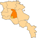 | |
| Rural communities |
| |
| Non-community settlements | ||
Categories:
- Populated places in Kotayk Province
- Yazidi populated places in Armenia
- Kotayk geography stubs