Zaraysk
Zaraysk
Зарайск | |
|---|---|
Town[1] | |
 Gostiny Dvor in Zaraysk | |
 Flag  Coat of arms | |
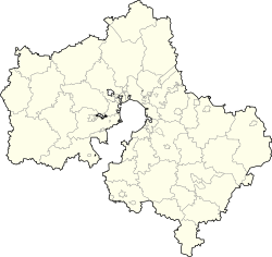
show Location of Zaraysk | |
 Zaraysk Location of Zaraysk | |
| Coordinates: 54°46′N 38°53′E / 54.767°N 38.883°ECoordinates: 54°46′N 38°53′E / 54.767°N 38.883°E | |
| Country | Russia |
| Federal subject | Moscow Oblast[1] |
| Administrative district | Zaraysky District[1] |
| Town | Zaraysk[1] |
| First mentioned | 1146 |
| Town status since | 1778 |
| Government | |
| • Body | [2] |
| Area | |
| • Total | 20.5 km2 (7.9 sq mi) |
| Elevation | 160 m (520 ft) |
| Population | |
| • Total | 24,645 |
| • Density | 1,200/km2 (3,100/sq mi) |
Administrative status | |
| • Capital of | Zaraysky District[1], Town of Zaraysk[1] |
Municipal status | |
| • Municipal district | Zaraysky Municipal District[4] |
| • Urban settlement | Zaraysk Urban Settlement[4] |
| • Capital of | Zaraysky Municipal District[4], Zaraysk Urban Settlement[4] |
| Time zone | UTC+3 (MSK |
| Postal code(s)[6] | 140600–140603 |
| Dialing code(s) | +7 49666 |
| OKTMO ID | 46616101001 |
| Website | zarrayon |


Zaraysk (Russian: Зара́йск) is a town and the administrative center of Zaraysky District in Moscow Oblast, Russia, located about 162 kilometers (101 mi) southeast from Moscow. Population: 24,645 (2010 Census);[3] 25,093 (2002 Census);[7] 26,958 (1989 Census).[8]
Geography[]
The town stands on the right bank of the Osyotr River, which is a right confluent of the Oka.
History[]

In the Middle Ages, the town belonged to the Princes of Ryazan and was known as Krasnoye (13th century) and Novogorodok-upon-the-Osyotr (14th and 15th centuries). From 1528 onwards, the town was called "the town of Nikola Zarazsky" and only by the beginning of 17th century it received its present name of Zaraysk. Before the 20th century, the town was a part of Ryazan Governorate and its architecture and vernacular dialect seem closer to Ryazan than to Moscow.[citation needed]
In the Grand Duchy of Moscow, Zaraysk was one of the fortresses forming a part of the Great Abatis Border, a fortified line of felled trees, barricades, fortresses, ditches, which were built by Russians as a protection against the hordes of the Crimean and Kazan Tatars. In 1531, a stone kremlin was built in place of the former wooden citadel. The Tatars failed to take the fortress during their raids in 1533, 1541, and 1570. It was briefly captured by the Lisowczycy during the Time of Troubles.

The brick-and-limestone kremlin in Zaraysk still stands and is kept in a rather good condition. The citadel is very small and has a rectangular shape, with only six towers, two of which are pierced by the gates.

Administrative and municipal status[]
Within the framework of administrative divisions, Zaraysk serves as the administrative center of Zaraysky District.[1] As an administrative division, it is incorporated within Zaraysky District as the Town of Zaraysk.[1] As a municipal division, the Town of Zaraysk is incorporated within Zaraysky Municipal District as Zaraysk Urban Settlement.[4]
Economy[]
Zaraysk is an industrial center of the district, with printing, building materials, foodstuff, and footwear industries.
Religion[]

There are five churches in Zaraysk, the oldest of which is St. Nicholas Cathedral, consecrated in 1681.
Archaeology[]
Zaraysk is an Upper Paleolithic site. In 2008, a few artefacts were found there:[9][10]
- A mammoth's rib with drawings on them which are thought to be the images of three mammoths.
- A small bone having an ornament of pattern of letters 'X' on it.
- Two figurines of humans—presumably of women.
- A piece with a conical shape made of a mammoth's bone. The upper part of the cone has been cut, it has a hole in the centre and many patterns. The purpose of this object is not known.
Sister cities[]
References[]
Notes[]
- ^ Jump up to: a b c d e f g h Resolution #123-PG
- ^ [1]
- ^ Jump up to: a b Russian Federal State Statistics Service (2011). Всероссийская перепись населения 2010 года. Том 1 [2010 All-Russian Population Census, vol. 1]. Всероссийская перепись населения 2010 года [2010 All-Russia Population Census] (in Russian). Federal State Statistics Service.
- ^ Jump up to: a b c d e Law #63/2005-OZ
- ^ "Об исчислении времени". Официальный интернет-портал правовой информации (in Russian). June 3, 2011. Retrieved January 19, 2019.
- ^ Почта России. Информационно-вычислительный центр ОАСУ РПО. (Russian Post). Поиск объектов почтовой связи (Postal Objects Search) (in Russian)
- ^ Russian Federal State Statistics Service (May 21, 2004). Численность населения России, субъектов Российской Федерации в составе федеральных округов, районов, городских поселений, сельских населённых пунктов – районных центров и сельских населённых пунктов с населением 3 тысячи и более человек [Population of Russia, Its Federal Districts, Federal Subjects, Districts, Urban Localities, Rural Localities—Administrative Centers, and Rural Localities with Population of Over 3,000] (XLS). Всероссийская перепись населения 2002 года [All-Russia Population Census of 2002] (in Russian).
- ^ Всесоюзная перепись населения 1989 г. Численность наличного населения союзных и автономных республик, автономных областей и округов, краёв, областей, районов, городских поселений и сёл-райцентров [All Union Population Census of 1989: Present Population of Union and Autonomous Republics, Autonomous Oblasts and Okrugs, Krais, Oblasts, Districts, Urban Settlements, and Villages Serving as District Administrative Centers]. Всесоюзная перепись населения 1989 года [All-Union Population Census of 1989] (in Russian). Институт демографии Национального исследовательского университета: Высшая школа экономики [Institute of Demography at the National Research University: Higher School of Economics]. 1989 – via Demoscope Weekly.
- ^ www.membrana.ru — Венеры каменного века найдены под Зарайском
- ^ Hizri Amirkhanov and Sergey Lev. New finds of art objects from the Upper Palaeolithic site of Zaraysk, Russia
Sources[]
- Губернатор Московской области. Постановление №123-ПГ от 28 сентября 2010 г. «Об учётных данных административно-территориальных и территориальных единиц Московской области», в ред. Постановления №252-ПГ от 26 июня 2015 г. «О внесении изменения в учётные данные административно-территориальных и территориальных единиц Московской области». Опубликован: "Информационный вестник Правительства МО", №10, 30 октября 2010 г. (Governor of Moscow Oblast. Resolution #123-PG of September 28, 2010 On the Inventory Data of the Administrative-Territorial and Territorial Units of Moscow Oblast, as amended by the Resolution #252-PG of June 26, 2015 On Amending the Inventory Data of the Administrative-Territorial and Territorial Units of Moscow Oblast. ).
- Московская областная Дума. Закон №63/2005-ОЗ от 28 февраля 2005 г. «О статусе и границах Зарайского муниципального района и вновь образованных в его составе муниципальных образований», в ред. Закона №147/2010-ОЗ от 26 ноября 2010 г. «О внесении изменений в Закон Московской области "О статусе и границах Зарайского муниципального района и вновь образованных в его составе муниципальных образований"». Вступил в силу со дня официального опубликования. Опубликован: "Ежедневные Новости. Подмосковье", №42, 10 марта 2005 г. (Moscow Oblast Duma. Law #63/2005-OZ of February 28, 2005 On the Status and the Borders of Zaraysky Municipal District and the Newly Established Municipal Formations Comprising It, as amended by the Law #147/2010-OZ of November 26, 2010 On Amending the Law of Moscow Oblast "On the Status and the Borders of Zaraysky Municipal District and the Newly Established Municipal Formations Comprising It". Effective as of the day of the official publication.).
Further reading[]
- (in Russian) Зарайск. Материалы для истории города XVI-XVIII столетий (Zaraysk. Materials for the History of the 16th-18th centuries (1888)). Available at Runivers.ru in DjVu and PDF formats.
External links[]
- (in Russian) Unofficial website of Zaraysk
- Small Towns of Russia. Zaraysk.
- (in Russian) Photos of Zaraysk
- Pictures of Zaraysk in 1995
- Russia Beyond the Headlines. Zaraysk, the "Grandfather City"
| show Historical towns and monasteries of the former Grand Duchy of Moscow |
|---|

- Cities and towns in Moscow Oblast
- Ryazan Governorate