Zeila Archipelago
 | |
 Zeila Archipelago | |
| Geography | |
|---|---|
| Location | Somaliland |
| Coordinates | Coordinates: 11°21′14″N 43°28′23″E / 11.35389°N 43.47306°E From 11°29.5′N 43°17′E / 11.4917°N 43.283°E to 11°21′N 43°28′E / 11.350°N 43.467°E |
| Archipelago | Zeila Archipelago |
| Total islands | 6 |
| Major islands | Sa'ad Din, Aibat, Ras Gomali. |
| Administration | |
| Demographics | |
| Ethnic groups | Uninhabited [1] |

The Sa'ad ad-Din Islands (Somali: Jasiirada Sacadadiin, Arabic: جزر سعد الدين), also Romanized as Sa'ad-ed-din[2] and known as the Zeila Archipelago,[3] are a group of islands off the northern coast of Somaliland. They are situated near the ancient city of Zeila.[4]
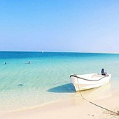
The Zeila Archipelago is made of six small islands all of which are low-lying and have sandy beaches.[5][6] The largest of these islands are Sacadin and Aibat,[7] which are six and nine miles off the coast of Zeila, respectively.[8] There is also a lighthouse at Aibat.[8]
Etymology & History[]


The name for the archipelago comes from the Somali Sultan Sa'ad ad-Din II who was killed by Emperor Yeshaq I of Abyssinia on the main island in 1415.[9][10] Along with his name, there are many different spelling for the island such as Sa'ad ed Din,[4] Sa'ad-ed-din,[2] and Sa'ad-ad-Din.[11] The archpeliogo is also known as the Zeila Archipelago[3] and the Sa'ad ad-Din group.[5]
Legendary Arab explorer Ahmad ibn Mājid wrote of the archipelago and a few other notable landmarks and ports of the northern Somali coast, including Zeila, Berbera, Xiis, Alula, Ruguuda, Maydh, Ceel-Sheekh, Siyara and El-Darad.[12]
The archipelago is the site where the remaining forces of Sheikh Bashir were shipped to after the conclusion of the 1945 Sheikh Bashir Rebellion.[13]
Environment[]
The Sa'ad ad-Din Islands are well known for their splendid coral reefs similar to those found on the southern coast of Oman.[4] These reefs are the most diverse and well formed coral reefs on the coast of the Gulf of Aden[14] and possibly the largest in the region.[15] From provincial counts, ninety-nine different species of coral from forty-three different generas have been found on the islands.[4]
There are also a hundred and thirty-two different species of coral fish found around the archipelago. Many of these species include those also found in the Red Sea, Gulf of Aden, and the Indian Ocean.[16]
The island of Sa'ad ad-Din and Aibat (called Ceebaad in Somali)[17] both are sites of major bird colonies.[18] On the island of Sa'ad ad-Din alone, there were more than 100,000 breeding pairs recorded.[7]
Following the 2004 Indian Ocean earthquake and tsunami, the International Union for Conservation of Nature (IUCN) and other NGO worked with local authorizes to establish protected areas and monitor fishers on the islands.[19]
Demographics[]
The archipelago currently has no permanent residents and is uninhabited, though it is still occasionally visited by tourists, local fishermen, and those who wish to honor Sa'ad ad-Din II.[1]
See also[]
- Ifat Sultanate
- Sa'ad ad-Din II
- Zeila
- Islands of Somaliland
- List of islands in the Indian Ocean
- Bajuni Islands
References[]
- ^ Jump up to: a b [Philip Briggs https://books.google.com/books?id=M6NI2FejIuwC&pg=PA154&lpg=PA154&dq=Sa%27ad+ad-Din+Islands&source=bl&ots=pcZDCLGxdj&sig=1XbocDUyly-3A_sHByX9VUp_DbU&hl=en&sa=X&ved=0ahUKEwjSlfPE7ZfOAhUS8mMKHXI0ACwQ6AEIXTAM#v=onepage&q=Sa'ad%20ad-Din%20Islands&f=false "Somaliland: With Addis Ababa & Eastern Ethiopia"] "Brandt Guides". Retrieved Jul 29, 2016.
- ^ Jump up to: a b H.N. Moldenke and A.L. Moldenke 1980, p. 502.
- ^ Jump up to: a b Jason Gurney 1966, p. 74.
- ^ Jump up to: a b c d T. R. McClanahan 2000, p. 273.
- ^ Jump up to: a b "ReefBase:: Global Database: Resources - Overview - Eastern Africa - Somaliland". Retrieved 2014-04-16.
- ^ "Regional Status of Breeding Seabirds in the Red Sea and the Gulf of Aden" (PDF). Retrieved 2014-04-17.
- ^ Jump up to: a b "Survey design for Proposed Marine Protected Areas" (PDF). pp. 20, 29. Retrieved 2014-04-16.
- ^ Jump up to: a b National Geospatial-Intelligence Agency 2007, p. 176.
- ^ Philip Briggs 2012, p. 10.
- ^ Mohamed Diriye Abdullahi 2001, p. 16.
- ^ Frederick Mercer Hunter 1877, p. 11.
- ^ "Ibn Majid". Medieval Science, Technology, and Medicine: An Encyclopedia. Routledge. 2005. ISBN 978-1-135-45932-1.
- ^ Annual Colonial Office Report on the Somaliland Protectorate, 1948. p. 31.
- ^ "Country Environmental Profile for Somalia" (PDF). p. 8. Retrieved 2014-04-16.
- ^ "Development and management of a network of marine protected areas in the Red Sea and Gulf of Aden region" (PDF). p. 745. Retrieved 2014-04-16.
- ^ T. R. McClanahan 2000, p. 274.
- ^ National Geospatial-Intelligence Agency 2007, p. 175.
- ^ Nigel Redman 2009, p. 29.
- ^ United Nations Environment Programme. 2005, p. 132.
Further reading[]
- T. R. McClanahan, C. R. C. Sheppard, D. O. Obura. Coral Reefs of the Indian Ocean: Their Ecology and Conservation: Their Ecology and Conservation (Oxford University Press, 2000) ISBN 0-19-535217-3
- H.N. Moldenke and A.L. Moldenke. A Sixth Summary of the Verbenaceae, Avicenniaceae, Stilbaceae, Chloanthaceae, Symphoremaceae, Nyctanthaceae, and Eriocaulaceae of the World as to Valid Taxa, Geographic Distribution and Synonymy (H.N. Moldenke and A.L. Moldenke, 1980)
- M. H. Schleyer, Robert M. Baldwin. Biodiversity Assessment of the Northern Somali Coast East of Berbera (IUCN Eastern Africa Regional Office, 1999)
- United Nations Environment Programme. After the Tsunami: Rapid Environmental Assessment (United Nations Environment Programme, 2005) ISBN 92-807-2565-3
- Philip Briggs. Somaliland (Bradt Travel Guides, 2012) ISBN 1-84162-371-7
- Mohamed Diriye Abdullahi. Culture and Customs of Somalia (Greenwood Publishing Group, 2001) ISBN 0-313-31333-4
- Frederick Mercer Hunter. An Account of the British Settlement of Aden in Arabia (Trübner, 1877)
- Élisée Reclus. The Earth and Its Inhabitants: Africa (D. Appleton, 1886)
- Jason Gurney. Sheba's coast (Hale, 1966)
- Nigel Redman, Terry Stevenson, John Fanshawe. Birds of the Horn of Africa: Ethiopia, Eritrea, Djibouti, Somalia and Socotra (A&C Black, 2009) ISBN 0-7136-6541-6
- National Geospatial-Intelligence Agency. Sailing Directions - Enroute (ProStar Publications, 2007) ISBN 1-57785-760-7
- Archipelagoes of Somaliland
- Islands of Somaliland
- Islands of Somalia